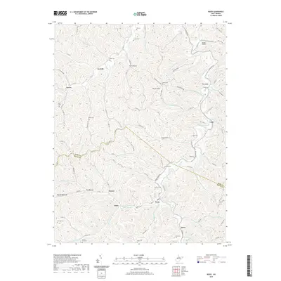
2019 Map of Reedy
USGS Topo · Published 2019About this map
Reedy serves as the central hub of this Appalachian landscape, where the Middle Fork and Right Fork converge. The terrain is defined by a dense network of high ridges, such as Buffalo Ridge and Fairview Ridge, which dictated the early settlement patterns and road placements. Smaller communities like Zackville, Sunflower, and Peewee are scattered along the narrow valley floors, connected by winding routes like Parkersburg Rd and Folly Run Rd. For those researching local families, the map is densely populated with small burial grounds, including the Board Cem, Roach Cem, and McClung Cem. These features, along with names like Morris Hollow and Happy Hollow, offer a detailed look at the rural character and genealogy of Roane and Wirt counties in the early 21st century.
Find a feature on this map
108 named features on this map. Tap any name to fly to it.
Don’t see what you’re looking for? This feature index may not catch every label — zoom into the map to look around manually.
Map Details
Editions of this 2019 Reedy Map
This is the sole edition of this map. No revisions or reprints were ever made.
Other maps of this area

1906 · Elizabeth
USGS Topo · 1:62,500

1906 · Belleville
USGS Topo · 1:62,500

1907 · Spencer
USGS Topo · 1:62,500

1907 · Ripley
USGS Topo · 1:62,500

1924 · Belleville
USGS Topo · 1:62,500

1924 · Elizabeth
USGS Topo · 1:62,500

1926 · Elizabeth
USGS Topo · 1:62,500

1926 · Belleville
USGS Topo · 1:62,500

1926 · Ripley
USGS Topo · 1:62,500

1928 · Spencer
USGS Topo · 1:62,500