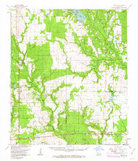
1961 Map of Reeves
USGS Topo · Published 1963About this map
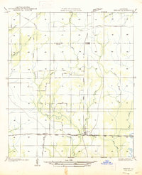
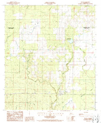
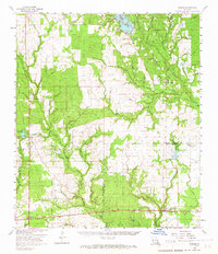
The boundary between Beauregard Parish and Allen Parish is defined by the winding course of Bundick Creek and Dry Creek in this early 1960s study. The landscape is heavily influenced by the presence of an Oil Field and numerous Oil Wells, particularly in the western sections near Longville. The rail-centered development of the era is evident in the junction at Fulton, where the Southern Pacific and Missouri Pacific railroads meet. The settlement at Reeves (Reaves Sta) serves as a key local hub along the southern rail line. To the north, the creation of Bundick Lake provides a major water feature in an area otherwise characterized by a dense network of branches and gullies, including Hurricane Creek and Thompson Gully. Rural community life is anchored by local institutions such as Magnolia Ch, Shiloh Ch, and the Dry Creek Cem.
Find a feature on this map
72 named features on this map. Tap any name to fly to it.
Don’t see what you’re looking for? This feature index may not catch every label — zoom into the map to look around manually.
Map Details
Editions of this 1961 Reeves Map
2 editions found
Historical Maps of Reeves Through Time
8 maps found