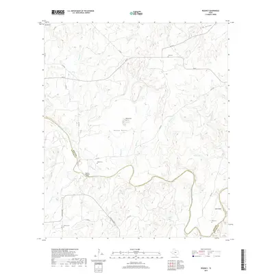
2019 Map of Regency
USGS Topo · Published 2019About this map
The Regency Suspension Bridge serves as a historic crossing point over the Colorado River at the border of Mills and San Saba counties. This central Texas landscape is defined by the winding river valley and several prominent local topographic features including Hanna Mtn and Round Mtn. For those researching local family histories, the map identifies several rural burial grounds scattered across the terrain, such as Hollis Cem in the north and Ratler Cem and Mesquite Cem to the south. The area transitions from the elevated Hanna Valley down toward the bottomlands where Wilcox Lake and numerous creeks like Rough Cr and Hog Cr feed into the main river channel. Small settlements and local roads like FM 574 connect these isolated landmarks across the valley floor.
Find a feature on this map
34 named features on this map. Tap any name to fly to it.
Don’t see what you’re looking for? This feature index may not catch every label — zoom into the map to look around manually.
Map Details
Editions of this 2019 Regency Map
This is the sole edition of this map. No revisions or reprints were ever made.
Other maps of this area

1885 · San Saba
USGS Topo · 1:125,000

1889 · Brownwood
USGS Topo · 1:125,000

1894 · Brownwood
USGS Topo · 1:125,000

1894 · San Saba
USGS Topo · 1:125,000

1925 · San Saba 2-a
USGS Topo · 1:48,000

1925 · Brownwood 3-d
USGS Topo · 1:48,000

1925 · San Saba 1-c
USGS Topo · 1:48,000

1925 · San Saba 1-b
USGS Topo · 1:48,000

1925 · San Saba 2-b
USGS Topo · 1:48,000

1925 · Brownwood 4-c
USGS Topo · 1:48,000