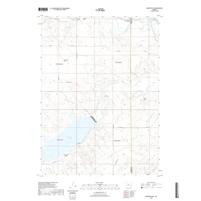
2018 Map of Register Cliff
USGS Topo · Published 2018About this map
Register Cliff stands as a prominent landmark along the North Platte River in this 2018 survey of the border between Platte and Goshen Counties. This area is defined by the confluence of major water systems, where the Laramie River flows toward the North Platte and the southern portion of the map is dominated by the expansive Grayrocks Reservoir. The landscape transitions from the aquatic environment of the reservoir to the high ground of Mummy Mtn and the broad Bettelyoun Flats. Local history and land use are etched into the terrain through features like the Register Cliff Cem and the White Rock Trce, alongside a network of rural routes such as S Guernsey Rd and Ft Laramie Rd that navigate the various draws, including Cottonwood Draw and County Line Draw.
Find a feature on this map
30 named features on this map. Tap any name to fly to it.
Don’t see what you’re looking for? This feature index may not catch every label — zoom into the map to look around manually.
Map Details
Editions of this 2018 Register Cliff Map
This is the sole edition of this map. No revisions or reprints were ever made.
Other maps of this area

1896 · Hartville
USGS Topo · 1:125,000

1901 · Hartville
USGS Topo · 1:125,000

1950 · Rockeagle
USGS Topo · 1:24,000

1950 · Guernsey
USGS Topo · 1:24,000

1950 · Casebier Hill
USGS Topo · 1:24,000

1950 · Fort Laramie
USGS Topo · 1:24,000

1950 · Register Cliff
USGS Topo · 1:24,000

1950 · Guernsey Reservoir
USGS Topo · 1:24,000

1951 · Guernsey Reservoir
USGS Topo · 1:24,000

1951 · Antelope Gap
USGS Topo · 1:24,000