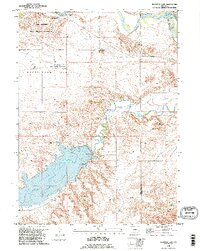
1990 Map of Register Cliff
USGS Topo · Published 1995About this map
The Oregon Trail passes through this section of Wyoming, marking a landscape defined by pioneer migration and early Western infrastructure. Register Cliff, a prominent landmark where emigrants carved their names into soft sandstone, is preserved alongside the Reg. Hist. Cliff Historical Monument and the site of a Pony Express Station. This area, near the Old Guernsey Ranch, shows the convergence of the North Platte River and the Laramie River, which support local agriculture via the Whalen Diversion Dam and various siphons and ditches. The terrain transitions from the open Bettelyoun Flats to the elevations of Mummy Mountain, while much of the northwest is occupied by the Camp Guernsey State Military Reservation. In the south, the expansive Grayrocks Reservoir dominates the drainage of the Laramie River, reflecting modern water management alongside nineteenth-century trail history.
Find a feature on this map
21 named features on this map. Tap any name to fly to it.
Don’t see what you’re looking for? This feature index may not catch every label — zoom into the map to look around manually.
Map Details
Editions of this 1990 Register Cliff Map
This is the sole edition of this map. No revisions or reprints were ever made.
Other maps of this area

1896 · Hartville
USGS Topo · 1:125,000

1901 · Hartville
USGS Topo · 1:125,000

1950 · Rockeagle
USGS Topo · 1:24,000

1950 · Guernsey
USGS Topo · 1:24,000

1950 · Casebier Hill
USGS Topo · 1:24,000

1950 · Fort Laramie
USGS Topo · 1:24,000

1950 · Register Cliff
USGS Topo · 1:24,000

1950 · Guernsey Reservoir
USGS Topo · 1:24,000

1951 · Guernsey Reservoir
USGS Topo · 1:24,000

1951 · Antelope Gap
USGS Topo · 1:24,000