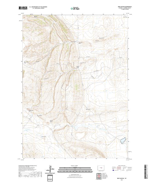
2021 Map of Reid Canyon
USGS Topo · Published 2021About this map
The drainage network of the S Fork Casper Cr defines the southern half of this landscape in Natrona County, where seasonal waterways like Spring Draw and Clarks Gulch carve through the high plains. To the north, the terrain becomes more complex as it rises toward Pine Mtn and the prominent Rattlesnake Hill. This 2021 survey shows a topography dominated by deep incisions and dry washes, including the namesake Reid Canyon and Baerthel Canyon near the western edge. A distinctive modern feature of this area is the unique naming of the local road network, which includes colorfully labeled routes such as Yukon Tater Rd, Tinkerbell Rd, and Big Cheese Rd, reflecting recent rural land use patterns. The map also traces more established landmarks like the Haystacks and the winding course of Haystack Draw in the northeast.
Find a feature on this map
32 named features on this map. Tap any name to fly to it.
Don’t see what you’re looking for? This feature index may not catch every label — zoom into the map to look around manually.
Map Details
Editions of this 2021 Reid Canyon Map
This is the sole edition of this map. No revisions or reprints were ever made.
Other maps of this area

1951 · Pine Mountain SW
USGS Topo · 1:24,000

1951 · Oil Mountain
USGS Topo · 1:24,000

1951 · Emigrant Gap NW
USGS Topo · 1:24,000

1951 · Poison Spider
USGS Topo · 1:24,000

1951 · Square Top Butte
USGS Topo · 1:24,000

1951 · Reid Canyon
USGS Topo · 1:24,000

1955 · Arminto
USGS Topo · 1:250,000

1955 · Casper
USGS Topo · 1:250,000

1958 · Casper
USGS Topo · 1:250,000

1958 · Arminto
USGS Topo · 1:250,000