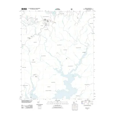
2011 Map of Reid
USGS Topo · Published 2011About this map
Lake Jocassee dominates the southern half of this landscape, its fingers reaching deep into the southern Appalachian valleys. This 2011 survey captures the area at the boundary of North and South Carolina, where the terrain is defined by a dense network of gaps and ridges. To the north, the settlement of Oakland and the Oakland Cemetery sit near Bear Wallow Springs, illustrating the established communities that overlook the high mountain basins. The transition from the high peaks of Misery Mountain and Gallbuster Mountain down to the water’s edge is marked by dramatic elevation drops, visible at Toxaway Falls and the remote Lower Falls along the Thompson River. This map provides a detailed view of the regional geography before modern development further altered the land between Lake Toxaway and the expansive waters of the Jocassee basin.
Find a feature on this map
77 named features on this map. Tap any name to fly to it.
Don’t see what you’re looking for? This feature index may not catch every label — zoom into the map to look around manually.
Map Details
Editions of this 2011 Reid Map
This is the sole edition of this map. No revisions or reprints were ever made.
Other maps of this area

1886 · Walhalla
USGS Topo · 1:125,000

1888 · Pickens
USGS Topo · 1:125,000

1891 · Cowee
USGS Topo · 1:125,000

1892 · Walhalla
USGS Topo · 1:125,000

1894 · Pickens
USGS Topo · 1:125,000

1896 · Walhalla
USGS Topo · 1:125,000

1897 · Cowee
USGS Topo · 1:125,000

1905 · Pisgah
USGS Topo · 1:125,000

1906 · Pisgah
USGS Topo · 1:125,000

1907 · Cowee
USGS Topo · 1:125,000