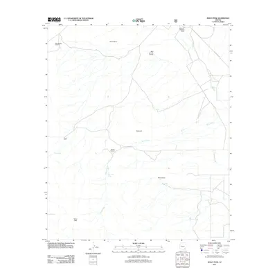
2011 Map of Reiley Peak
USGS Topo · Published 2011About this map
Reiley Peak and the high desert terrain of Cochise County define this area of southeastern Arizona. This 2011 survey illustrates a landscape of isolated ranches and essential water management features, centered around the Froelich Ranch and the drainage systems feeding into the Sulphur Springs Valley. The topographic detail reveals a network of canyons including Box Spring Canyon, Mud Springs Canyon, and Rose Canyon, which channel seasonal runoff toward Ash Creek. Human presence is marked by a reliance on strategic water sources such as Poer Spring, Mud Springs, and the Upper Reiley Tank, alongside livestock infrastructure like Rose Tank. Local transit is limited to unpaved access like W Ash Creek Rd, reflecting the remote ranching character of the region. Prominent landmarks such as Hooker Butte and Reiley Hill stand as navigational anchors in this arid environment.
Find a feature on this map
17 named features on this map. Tap any name to fly to it.
Don’t see what you’re looking for? This feature index may not catch every label — zoom into the map to look around manually.
Map Details
Editions of this 2011 Reiley Peak Map
This is the sole edition of this map. No revisions or reprints were ever made.
Other maps of this area

1922 · Willcox
USGS Topo · 1:125,000

1940 · Sierra Bonita Ranch
USGS Topo · 1:62,500

1942 · Sierra Bonita Ranch
USGS Topo · 1:62,500

1942 · Mt. Graham
USGS Topo · 1:62,500

1943 · Willcox
USGS Topo · 1:62,500

1943 · Sierra Bonita Ranch
USGS Topo · 1:62,500

1943 · Winchester Mts.
USGS Topo · 1:62,500

1945 · Mt. Graham
USGS Topo · 1:62,500

1945 · Winchester Mts.
USGS Topo · 1:62,500

1954 · Silver City
USGS Topo · 1:250,000