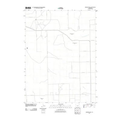
2010 Map of Reiradon Hill
USGS Topo · Published 2010About this map
North Reiradon Hill and South Reiradon Hill define the high ground of this Logan County landscape in 2010. The survey reveals a sparse settlement pattern dominated by agricultural and ranching infrastructure, such as the northern site at Buffalo Camp and the western outpost at Twin Mills. A strict grid of county roads, including County Rd 61 and County Rd 51, dissects the terrain into large sections, facilitating transport across the high plains. Natural drainage is shaped by the ephemeral paths of North Fork Frenchman Creek in the northeast and Sandy Creek in the southeast. The concentration of labeled landmarks like Eagle Point Hill amidst the extensive road network indicates a landscape managed for cattle and dryland farming, where individual named sites serve as critical navigation points in an otherwise open horizon.
Find a feature on this map
25 named features on this map. Tap any name to fly to it.
Don’t see what you’re looking for? This feature index may not catch every label — zoom into the map to look around manually.
Map Details
Editions of this 2010 Reiradon Hill Map
This is the sole edition of this map. No revisions or reprints were ever made.
Other maps of this area

1951 · Reiradon Hill
USGS Topo · 1:24,000

1951 · Sterling South
USGS Topo · 1:24,000

1951 · Sterling North
USGS Topo · 1:24,000

1951 · Galien
USGS Topo · 1:24,000

1954 · Sterling
USGS Topo · 1:250,000

1958 · Sterling
USGS Topo · 1:250,000

1962 · Uhler Ranch
USGS Topo · 1:24,000

1972 · Glacken Hill
USGS Topo · 1:24,000

1972 · Leroy
USGS Topo · 1:24,000

1973 · Buffalo Springs Ranch NW
USGS Topo · 1:24,000