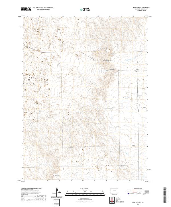
2022 Map of Reiradon Hill
USGS Topo · Published 2022About this map
Twin Mills stands as the primary landmark in this section of Logan County, positioned among a network of county roads that define the rural grid of northeastern Colorado. The topography is characterized by subtle elevations such as North Reiradon Hill, South Reiradon Hill, and Eagle Point Hill, which rise above the surrounding plains. Drainage patterns are shaped by the N Fork Frenchman Cr in the northeast and Sandy Cr in the southeast, revealing how water courses influenced the early layout of regional transit and land division. This survey captures a landscape primarily defined by its agricultural infrastructure and the systematic division of high plains territory.
Find a feature on this map
24 named features on this map. Tap any name to fly to it.
Don’t see what you’re looking for? This feature index may not catch every label — zoom into the map to look around manually.
Map Details
Editions of this 2022 Reiradon Hill Map
This is the sole edition of this map. No revisions or reprints were ever made.
Other maps of this area

1951 · Reiradon Hill
USGS Topo · 1:24,000

1951 · Sterling South
USGS Topo · 1:24,000

1951 · Sterling North
USGS Topo · 1:24,000

1951 · Galien
USGS Topo · 1:24,000

1954 · Sterling
USGS Topo · 1:250,000

1958 · Sterling
USGS Topo · 1:250,000

1962 · Uhler Ranch
USGS Topo · 1:24,000

1972 · Glacken Hill
USGS Topo · 1:24,000

1972 · Leroy
USGS Topo · 1:24,000

1973 · Buffalo Springs Ranch NW
USGS Topo · 1:24,000