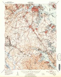
1947 Map of Relay
USGS Topo · Published 1954About this map
The Patapsco River and its industrial corridors define this mid-century landscape just south of Baltimore, captured during a period of massive infrastructure growth. The construction of the Baltimore Friendship International Airport is a central focal point, showing the early footprint of what would become a major regional hub. Surrounding the airport, established communities like Linthicum Heights, Glen Burnie, and Lansdowne show the post-war transition toward suburbanization, while the presence of the Baltimore and Ohio and Pennsylvania railroads highlights the area's continued reliance on heavy transport.
Find a feature on this map
189 named features on this map. Tap any name to fly to it.
Don’t see what you’re looking for? This feature index may not catch every label — zoom into the map to look around manually.
Map Details
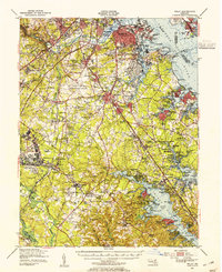
Editions of this 1947 Relay Map
2 editions found
Other maps of this area

1892 · Laurel
USGS Topo · 1:62,500

1892 · Ellicott
USGS Topo · 1:62,500

1892 · Owensville
USGS Topo · 1:62,500

1892 · Annapolis
USGS Topo · 1:62,500

1893 · North Point
USGS Topo · 1:62,500

1893 · Gunpowder
USGS Topo · 1:62,500

1894 · Ellicott
USGS Topo · 1:62,500

1894 · Laurel
USGS Topo · 1:62,500

1894 · Baltimore
USGS Topo · 1:62,500

1894 · Relay
USGS Topo · 1:62,500