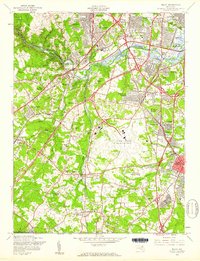
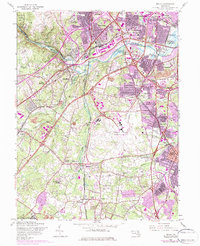
1957 Map of Relay
USGS Topo · Published 1960About this map
Baltimore Friendship International Airport anchors the landscape in this mid-century survey, illustrating a critical era of Maryland's aviation and suburban expansion. The Patapsco River and its valley divide the terrain, with Patapsco State Park preserving natural green space against the rapid growth of settlements like Arbutus, Lansdowne, and Linthicum Heights. The transport network is dense, featuring the Baltimore-Washington Parkway alongside a complex web of rail lines, including the Pennsylvania Railroad and the Baltimore & Ohio RR.
Find a feature on this map
76 named features on this map. Tap any name to fly to it.
Don’t see what you’re looking for? This feature index may not catch every label — zoom into the map to look around manually.
Map Details
Editions of this 1957 Relay Map
5 editions found
Other maps of this area

1892 · Laurel
USGS Topo · 1:62,500

1892 · Ellicott
USGS Topo · 1:62,500

1894 · Ellicott
USGS Topo · 1:62,500

1894 · Laurel
USGS Topo · 1:62,500

1894 · Baltimore
USGS Topo · 1:62,500

1894 · Relay
USGS Topo · 1:62,500

1897 · Laurel
USGS Topo · 1:62,500

1899 · Baltimore
USGS Topo · 1:62,500

1904 · Baltimore
USGS Topo · 1:62,500

1906 · Ellicott
USGS Topo · 1:62,500