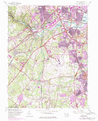
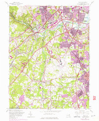
1957 Map of Relay
USGS Topo · Published 1984About this map
The Patapsco River corridor serves as the primary topographical and industrial axis for this 1957 survey of the Maryland suburbs. The landscape is defined by the rapid infrastructure expansion of the mid-20th century, notably the Baltimore Friendship International Airport and the complex intersections of the Baltimore Washington Parkway. Significant rail networks including the Baltimore & Ohio Railroad and the Penn Central line bisect older communities like Elkridge and Relay, illustrating the transition from 19th-century transit nodes to modern highway-oriented development.
Find a feature on this map
69 named features on this map. Tap any name to fly to it.
Don’t see what you’re looking for? This feature index may not catch every label — zoom into the map to look around manually.
Map Details
Editions of this 1957 Relay Map
5 editions found
Other maps of this area

1892 · Laurel
USGS Topo · 1:62,500

1892 · Ellicott
USGS Topo · 1:62,500

1894 · Ellicott
USGS Topo · 1:62,500

1894 · Laurel
USGS Topo · 1:62,500

1894 · Baltimore
USGS Topo · 1:62,500

1894 · Relay
USGS Topo · 1:62,500

1897 · Laurel
USGS Topo · 1:62,500

1899 · Baltimore
USGS Topo · 1:62,500

1904 · Baltimore
USGS Topo · 1:62,500

1906 · Ellicott
USGS Topo · 1:62,500