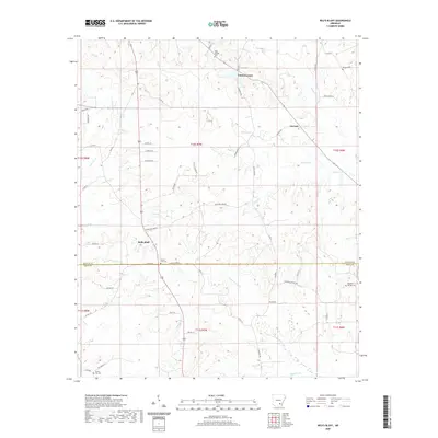
2020 Map of Relfs Bluff
USGS Topo · Published 2020About this map
Agricultural lands and low-lying drainages define the landscape of south-central Arkansas, where the settlement of Garnett serves as a local crossroads. This 2020 edition provides a contemporary view of a region historically rooted in timber and farming, positioned along the border where Lincoln and Drew counties meet. The geography is characterized by a network of creeks and small water bodies that have shaped local land use and boundaries for generations. Researchers will find a rural terrain defined by clear property lines and secondary roads that follow the natural contours of the land, illustrating the persistent character of these coastal plain communities into the twenty-first century.
Find a feature on this map
1 named feature on this map. Tap any name to fly to it.
Don’t see what you’re looking for? This feature index may not catch every label — zoom into the map to look around manually.
Map Details
Editions of this 2020 Relfs Bluff Map
This is the sole edition of this map. No revisions or reprints were ever made.
Other maps of this area

1935 · Feenyville
USGS Topo · 1:62,500

1935 · Cominto
USGS Topo · 1:62,500

1935 · Rotan
USGS Topo · 1:62,500

1953 · Greenwood
USGS Topo · 1:250,000

1956 · Greenwood
USGS Topo · 1:250,000

1960 · Collins NW
USGS Topo · 1:24,000

1960 · Collins
USGS Topo · 1:62,500
1964 · Avery
USGS Topo · 1:24,000
1964 · Tyro
USGS Topo · 1:24,000

1966 · Monticello North
USGS Topo · 1:24,000