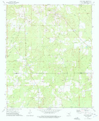
1973 Map of Relfs Bluff
USGS Topo · Published 1975About this map
Relfs Bluff and the nearby crossroads of Little Garnett anchor this rural landscape along the boundary of Lincoln and Drew Counties. The 1970s terrain is defined by a dense network of small waterways, including Chance Creek and Twomile Creek, which dictate the placement of farms and gravel operations. The abundance of Gravel Pits scattered across the quadrangle points to the local extractive industry of the era.
Find a feature on this map
29 named features on this map. Tap any name to fly to it.
Don’t see what you’re looking for? This feature index may not catch every label — zoom into the map to look around manually.
Map Details
Editions of this 1973 Relfs Bluff Map
This is the sole edition of this map. No revisions or reprints were ever made.
Other maps of this area

1935 · Feenyville
USGS Topo · 1:62,500

1935 · Cominto
USGS Topo · 1:62,500

1935 · Rotan
USGS Topo · 1:62,500

1953 · Greenwood
USGS Topo · 1:250,000

1956 · Greenwood
USGS Topo · 1:250,000

1960 · Collins NW
USGS Topo · 1:24,000

1960 · Collins
USGS Topo · 1:62,500
1964 · Avery
USGS Topo · 1:24,000
1964 · Tyro
USGS Topo · 1:24,000

1966 · Monticello North
USGS Topo · 1:24,000