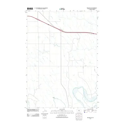
2012 Map of Reliance SE
USGS Topo · Published 2012About this map
The White River winds through the southern reaches of this Lyman County landscape, shaping a wide alluvial plain defined by its distinctive curves and sandbars. This drainage basin is a central geographical element of the region, receiving smaller tributaries like Red Butte Cr and the topographic drainage of Wagner Draw. Further north, the prairie is segmented by a strictly gridded road network, including 248th St and 333rd Ave, which facilitate movement across the agricultural expanse between the river and the northern watercourses.
Find a feature on this map
8 named features on this map. Tap any name to fly to it.
Don’t see what you’re looking for? This feature index may not catch every label — zoom into the map to look around manually.
Map Details
Editions of this 2012 Reliance SE Map
This is the sole edition of this map. No revisions or reprints were ever made.
Other maps of this area

1935 · Chamberlain
USGS Topo · 1:62,500

1939 · Chamberlain
USGS Topo · 1:62,500

1940 · Iona
USGS Topo · 1:62,500

1944 · Iona
USGS Topo · 1:62,500

1952 · Reliance SW
USGS Topo · 1:24,000

1952 · Reliance SE
USGS Topo · 1:24,000

1952 · Hamill NW
USGS Topo · 1:24,000

1952 · Hamill NE
USGS Topo · 1:24,000

1952 · Oacoma
USGS Topo · 1:24,000

1952 · Iona NW
USGS Topo · 1:24,000