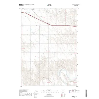
2017 Map of Reliance SE
USGS Topo · Published 2017About this map
The town of Reliance sits at the northern edge of this Lyman County landscape, where the prairie topography begins its descent toward the winding White River. This 2017 survey documents a modern rural environment defined by a rigid section-line road network, including 244th St and 328th Ave, which cuts across the natural drainage patterns of American Crow Cr and Big Cr. The southern reaches of the map are dominated by the significant meanders and wetlands of the White River, a stark hydrological contrast to the upland terrain incised by Wagner Draw. Interstate 90 and Hwy 16 serve as the primary east-west arteries, reflecting the contemporary transportation infrastructure that links these remote agricultural townships and supports the regional economy between the Missouri River and the western plains.
Find a feature on this map
25 named features on this map. Tap any name to fly to it.
Don’t see what you’re looking for? This feature index may not catch every label — zoom into the map to look around manually.
Map Details
Editions of this 2017 Reliance SE Map
This is the sole edition of this map. No revisions or reprints were ever made.
Other maps of this area

1935 · Chamberlain
USGS Topo · 1:62,500

1939 · Chamberlain
USGS Topo · 1:62,500

1940 · Iona
USGS Topo · 1:62,500

1944 · Iona
USGS Topo · 1:62,500

1952 · Reliance SW
USGS Topo · 1:24,000

1952 · Reliance SE
USGS Topo · 1:24,000

1952 · Hamill NW
USGS Topo · 1:24,000

1952 · Hamill NE
USGS Topo · 1:24,000

1952 · Oacoma
USGS Topo · 1:24,000

1952 · Iona NW
USGS Topo · 1:24,000