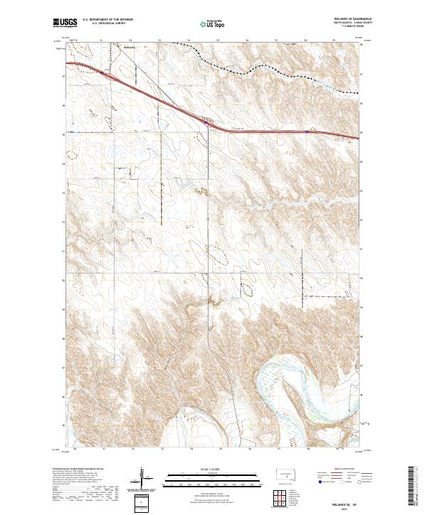
2021 Map of Reliance SE
USGS Topo · Published 2021About this map
The Reliance settlement area is captured here during the early 21st century, positioned within the high plains of Lyman County. This landscape is defined by the sharp transition between upland agricultural plateaus and the deeply carved drainage basins of the Missouri River watershed. While the northern portion of the map is dominated by the modern transportation corridor of State Hwy 248, the southern reaches reveal the intricate, winding course of the White River. The topography shifts from the level sections of the Public Land Survey System to the complex draws and breaks of Wagner Draw and Big Cr. This juxtaposition highlights how the local environment dictated early settlement patterns, with development clinging to the high ground while the river valley remained a dynamic, shifting natural boundary.
Find a feature on this map
20 named features on this map. Tap any name to fly to it.
Don’t see what you’re looking for? This feature index may not catch every label — zoom into the map to look around manually.
Map Details
Editions of this 2021 Reliance SE Map
This is the sole edition of this map. No revisions or reprints were ever made.
Other maps of this area

1935 · Chamberlain
USGS Topo · 1:62,500

1939 · Chamberlain
USGS Topo · 1:62,500

1940 · Iona
USGS Topo · 1:62,500

1944 · Iona
USGS Topo · 1:62,500

1952 · Reliance SW
USGS Topo · 1:24,000

1952 · Reliance SE
USGS Topo · 1:24,000

1952 · Hamill NW
USGS Topo · 1:24,000

1952 · Hamill NE
USGS Topo · 1:24,000

1952 · Oacoma
USGS Topo · 1:24,000

1952 · Iona NW
USGS Topo · 1:24,000