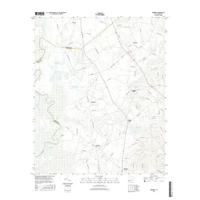
2017 Map of Rembert
USGS Topo · Published 2017About this map
Boykin and Rembert anchor this South Carolina landscape where the borders of Kershaw, Richland, and Sumter counties converge. The topography is defined by the significant wetlands of the Wateree River basin, including English Swamp and White Marsh Swamp. This 2017 survey reflects a rural corridor shaped by water and early industry, evidenced by the clustered mill sites like Ellerbees Mill and Dinkins Mill, each with its respective millpond. These features suggest a history of localized water-powered processing along tributaries such as Swift Creek and Rafting Cr.
Find a feature on this map
84 named features on this map. Tap any name to fly to it.
Don’t see what you’re looking for? This feature index may not catch every label — zoom into the map to look around manually.
Map Details
Editions of this 2017 Rembert Map
This is the sole edition of this map. No revisions or reprints were ever made.
Other maps of this area

1938 · Hagood
USGS Topo · 1:62,500

1941 · Spartanburg
USGS Topo · 1:250,000

1942 · Camden
USGS Topo · 1:125,000

1943 · Eastover
USGS Topo · 1:62,500

1946 · Sumter
USGS Topo · 1:62,500

1953 · Camden South
USGS Topo · 1:24,000

1953 · Eastover
USGS Topo · 1:24,000

1953 · Lugoff
USGS Topo · 1:24,000

1953 · Wedgefield
USGS Topo · 1:24,000

1953 · Rembert
USGS Topo · 1:24,000