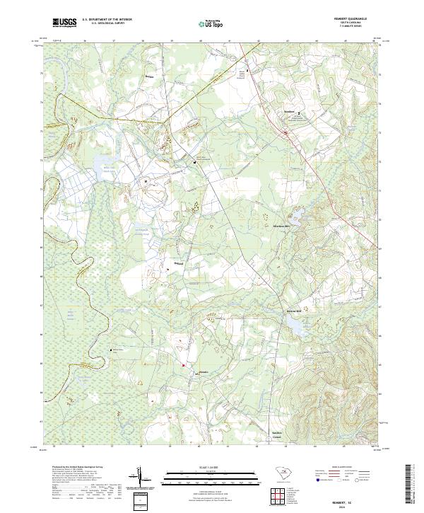
2024 Map of Rembert
USGS Topo · Published 2024About this map
The Wateree River forms the western boundary of this landscape, where the alluvial lowlands of English Swamp and White Marsh Swamp meet the rising terrain of the Sandhills. This 2024 survey captures a rural South Carolina corridor defined by historic mill sites and dispersed agricultural settlements. Communities like Rembert and Hagood are linked by a network of local roads such as Boykin Rd and Horatio Hagood Rd, while several church graveyards, including Mount Bethel Church Graveyard and Good Hope Church Graveyard, serve as important markers for family history research.
Find a feature on this map
92 named features on this map. Tap any name to fly to it.
Don’t see what you’re looking for? This feature index may not catch every label — zoom into the map to look around manually.
Map Details
Editions of this 2024 Rembert Map
This is the sole edition of this map. No revisions or reprints were ever made.
Other maps of this area

1938 · Hagood
USGS Topo · 1:62,500

1941 · Spartanburg
USGS Topo · 1:250,000

1942 · Camden
USGS Topo · 1:125,000

1943 · Eastover
USGS Topo · 1:62,500

1946 · Sumter
USGS Topo · 1:62,500

1953 · Camden South
USGS Topo · 1:24,000

1953 · Eastover
USGS Topo · 1:24,000

1953 · Lugoff
USGS Topo · 1:24,000

1953 · Wedgefield
USGS Topo · 1:24,000

1953 · Rembert
USGS Topo · 1:24,000