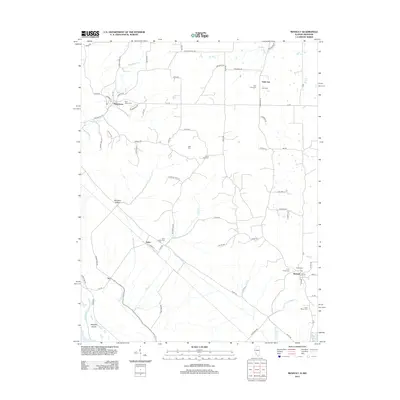
2012 Map of Renault
USGS Topo · Published 2012About this map
The small village of Maeystown sits at the northern edge of this Monroe County landscape, characterized by a series of creeks flowing toward the Mississippi River floodplain. The area's settlement history is preserved through numerous family and community burial grounds, such as Dick Cem, Grant Pass Cem, and Studt Cem. The community of Fults serves as a central hub near Morrison Hollow, while the hamlet of Renault is situated in the southeastern corner near the winding Onemile Race Cr. The terrain is marked by a complex network of local roads like Kaskaskia RD and Maeystown RD, reflecting a rural agricultural pattern that has persisted for generations. A notable transition occurs at Beagles Island and Lake Mildred, where the upland topography meets the lower drainage areas of the Old Maeystown Cr and Fults Cr systems.
Find a feature on this map
68 named features on this map. Tap any name to fly to it.
Don’t see what you’re looking for? This feature index may not catch every label — zoom into the map to look around manually.
Map Details
Editions of this 2012 Renault Map
This is the sole edition of this map. No revisions or reprints were ever made.
Other maps of this area

1910 · Waterloo
USGS Topo · 1:62,500

1912 · Kimmswick
USGS Topo · 1:62,500

1913 · Waterloo
USGS Topo · 1:62,500

1915 · Renault
USGS Topo · 1:62,500

1915 · Crystal City
USGS Topo · 1:62,500

1916 · Kimmswick
USGS Topo · 1:62,500

1940 · Renault
USGS Topo · 1:62,500

1948 · Kimmswick
USGS Topo · 1:62,500

1949 · Saint Louis
USGS Topo · 1:250,000

1949 · Crystal City
USGS Topo · 1:62,500