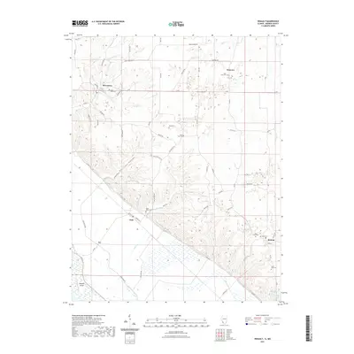
2021 Map of Renault
USGS Topo · Published 2021About this map
The Mississippi River bluff line and its agricultural hinterlands define this portion of Monroe County, Illinois. The settlement of Maeystown sits at the northern edge of the quadrangle, with the landscape transitioning from the dissected uplands of Morrison Hollow down toward the flat drainage basins of Fults and the bottomlands. The map is particularly notable for its concentration of family and community burial sites, including the Dick Cem and Grant Pass Cem positioned along the winding Brandt Rd.
Find a feature on this map
67 named features on this map. Tap any name to fly to it.
Don’t see what you’re looking for? This feature index may not catch every label — zoom into the map to look around manually.
Map Details
Editions of this 2021 Renault Map
This is the sole edition of this map. No revisions or reprints were ever made.
Other maps of this area

1910 · Waterloo
USGS Topo · 1:62,500

1912 · Kimmswick
USGS Topo · 1:62,500

1913 · Waterloo
USGS Topo · 1:62,500

1915 · Renault
USGS Topo · 1:62,500

1915 · Crystal City
USGS Topo · 1:62,500

1916 · Kimmswick
USGS Topo · 1:62,500

1940 · Renault
USGS Topo · 1:62,500

1948 · Kimmswick
USGS Topo · 1:62,500

1949 · Saint Louis
USGS Topo · 1:250,000

1949 · Crystal City
USGS Topo · 1:62,500