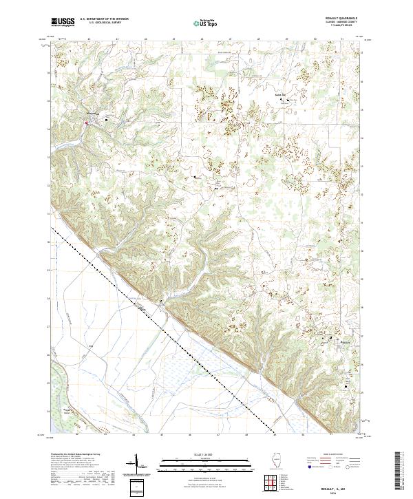
2024 Map of Renault
USGS Topo · Published 2024About this map
Maeystown and the bluffs of southern Monroe County define this landscape, where the elevation drops sharply from upland ridges into the bottomlands of the Mississippi River floodplain. The terrain is deeply incised by drainages like Morrison Hollow and Maeystown Creek, creating a complex network of ridges that historically dictated the placement of settlements and cemeteries. In the lower elevations, the human imprint is marked by drainage engineering such as the Fults Creek Ditch and Nine-mile Race Creek, designed to manage the fertile but swampy flats near Cavanah Lake. Local history and genealogy are well-represented by numerous family and community burial grounds scattered across the heights, including Saint Johns Cem, Zion Cem, and the Grant Pass Cem. The small hamlets of Fults, Saint Joe, and Renault serve as anchors for the rural road network connecting these distinct topographic zones.
Find a feature on this map
61 named features on this map. Tap any name to fly to it.
Don’t see what you’re looking for? This feature index may not catch every label — zoom into the map to look around manually.
Map Details
Editions of this 2024 Renault Map
This is the sole edition of this map. No revisions or reprints were ever made.
Other maps of this area

1910 · Waterloo
USGS Topo · 1:62,500

1912 · Kimmswick
USGS Topo · 1:62,500

1913 · Waterloo
USGS Topo · 1:62,500

1915 · Renault
USGS Topo · 1:62,500

1915 · Crystal City
USGS Topo · 1:62,500

1916 · Kimmswick
USGS Topo · 1:62,500

1940 · Renault
USGS Topo · 1:62,500

1948 · Kimmswick
USGS Topo · 1:62,500

1949 · Saint Louis
USGS Topo · 1:250,000

1949 · Crystal City
USGS Topo · 1:62,500