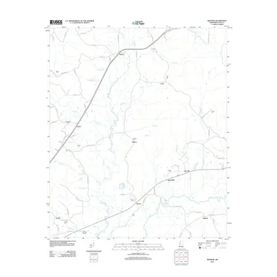
2012 Map of Renfroe
USGS Topo · Published 2012About this map
Lobutcha Cr and the Pearl River define the winding waterways of this Mississippi landscape, which features a dense network of family and community cemeteries. The small settlements of Renfroe, Battle Bluff, and Pearl Hill anchor a rural region where small creeks like Battle Br and Indian Br drain into the river system. Genealogy researchers will find numerous burial sites throughout the quadrangle, including the Sunrise Cem, Midway Cem, and the Reformation Cem near Luther. Significant local landmarks like Leake Memorial Gardens and Lee Lake appear alongside a grid of local roads such as Reformation Rd and Gaddis Rd, reflecting a settlement pattern deeply tied to the land and its numerous small tributaries.
Find a feature on this map
84 named features on this map. Tap any name to fly to it.
Don’t see what you’re looking for? This feature index may not catch every label — zoom into the map to look around manually.
Map Details
Editions of this 2012 Renfroe Map
This is the sole edition of this map. No revisions or reprints were ever made.
Other maps of this area

1953 · Meridian
USGS Topo · 1:250,000

1957 · Meridian
USGS Topo · 1:250,000

1961 · Carthage
USGS Topo · 1:62,500

1962 · Edinburg
USGS Topo · 1:62,500

1962 · Thomastown
USGS Topo · 1:62,500

1965 · Meridian
USGS Topo · 1:250,000

1972 · McAfee
USGS Topo · 1:24,000

1972 · Madden
USGS Topo · 1:24,000

1984 · Carthage
USGS Topo · 1:100,000
1989 · Singleton
USGS Topo · 1:24,000