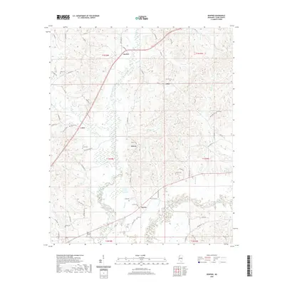
2020 Map of Renfroe
USGS Topo · Published 2020About this map
Lobutcha Creek defines the central topography of this Leake County landscape, carving a path through numerous small settlements including Renfroe, Midway, and Sunrise. The area is notably dense with local burial sites, such as Atkins Cem and Zion Hill Cem, providing significant data points for genealogists tracing family histories in these rural communities. To the south, the terrain descends toward the Pearl River and Gray Lake, where the wetland systems of the river valley emerge. The road network, including Reformation Rd and Battle Bluff Rd, connects isolated points like Luther and Coosa across a landscape of subtle ridges and seasonal stream branches such as Still Br and Indian Br. This survey illustrates the persistent rural character of the region, where community identity remains tied to these long-standing landmarks and small local clusters.
Find a feature on this map
79 named features on this map. Tap any name to fly to it.
Don’t see what you’re looking for? This feature index may not catch every label — zoom into the map to look around manually.
Map Details
Editions of this 2020 Renfroe Map
This is the sole edition of this map. No revisions or reprints were ever made.
Other maps of this area

1953 · Meridian
USGS Topo · 1:250,000

1957 · Meridian
USGS Topo · 1:250,000

1961 · Carthage
USGS Topo · 1:62,500

1962 · Edinburg
USGS Topo · 1:62,500

1962 · Thomastown
USGS Topo · 1:62,500

1965 · Meridian
USGS Topo · 1:250,000

1972 · McAfee
USGS Topo · 1:24,000

1972 · Madden
USGS Topo · 1:24,000

1984 · Carthage
USGS Topo · 1:100,000
1989 · Singleton
USGS Topo · 1:24,000