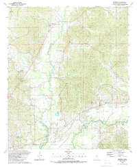
1989 Map of Renfroe
USGS Topo · Published 1989About this map
The Pearl River winds through this southern portion of Leake County, defining a landscape of creek-fed bottoms and scattered rural communities. By the late 1980s, the area remained characterized by its network of small country churches and cemeteries, such as Mt Charity Ch and Mary Bethel Ch, which served as the social anchors for settlements like Renfroe and Sunrise. The meandering course of Lobutcha Creek dominates the central terrain, eventually feeding into the river system.
Find a feature on this map
35 named features on this map. Tap any name to fly to it.
Don’t see what you’re looking for? This feature index may not catch every label — zoom into the map to look around manually.
Map Details
Editions of this 1989 Renfroe Map
This is the sole edition of this map. No revisions or reprints were ever made.
Other maps of this area

1953 · Meridian
USGS Topo · 1:250,000

1957 · Meridian
USGS Topo · 1:250,000

1961 · Carthage
USGS Topo · 1:62,500

1962 · Edinburg
USGS Topo · 1:62,500

1962 · Thomastown
USGS Topo · 1:62,500

1965 · Meridian
USGS Topo · 1:250,000

1972 · McAfee
USGS Topo · 1:24,000

1972 · Madden
USGS Topo · 1:24,000

1984 · Carthage
USGS Topo · 1:100,000
1989 · Singleton
USGS Topo · 1:24,000