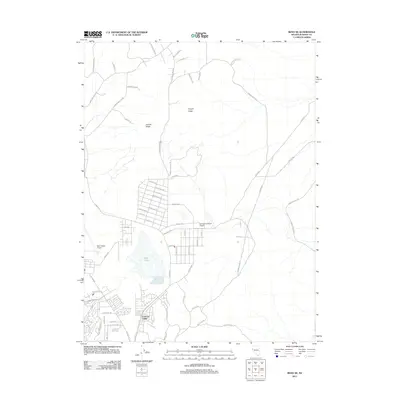
2011 Map of Reno NE
USGS Topo · Published 2011About this map
Swan Lake lies at the center of this 2011 survey, a seasonal water body that defines the hydrology of the closed basin north of Reno. The growing residential street networks of Lemmon Valley push toward the lake's western and southern margins, showing the transition from open high-desert terrain to suburban development. This era is marked by the presence of regional aviation hubs including the Reno-Stead Airport in the southwest and the Youngberg Ranch Airport further east, reflecting the area's importance for transportation and light industry.
Find a feature on this map
64 named features on this map. Tap any name to fly to it.
Don’t see what you’re looking for? This feature index may not catch every label — zoom into the map to look around manually.
Map Details
Editions of this 2011 Reno NE Map
This is the sole edition of this map. No revisions or reprints were ever made.
Other maps of this area

1891 · Reno
USGS Topo · 1:125,000

1893 · Reno
USGS Topo · 1:125,000

1950 · Reno
USGS Topo · 1:62,500

1951 · Reno
USGS Topo · 1:62,500

1957 · Sutcliffe
USGS Topo · 1:62,500
1957 · Vista
USGS Topo · 1:24,000

1957 · Dogskin Mountain
USGS Topo · 1:62,500

1957 · Spanish Springs Valley
USGS Topo · 1:62,500

1957 · Reno
USGS Topo · 1:250,000

1959 · Reno
USGS Topo · 1:250,000