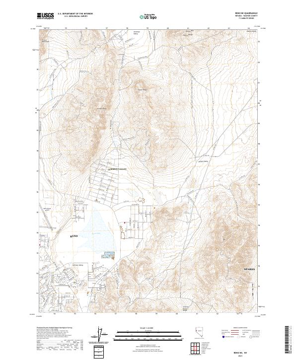
2021 Map of Reno NE
USGS Topo · Published 2021About this map
Lemmon Valley and the northern reaches of Reno anchor this contemporary look at the high desert terrain of Washoe County. The landscape is defined by the proximity of the Reno/Stead Airport and the expansive basin of Swan Lake, which sits at the center of a rapidly developing residential corridor. The surrounding topography includes the French Mountains to the northwest and the Hungry Range to the northeast, illustrating the sharp contrast between suburban expansion and the arid, unpopulated slopes of Coyote Ridge and Juniper Ridge.
Find a feature on this map
100 named features on this map. Tap any name to fly to it.
Don’t see what you’re looking for? This feature index may not catch every label — zoom into the map to look around manually.
Map Details
Editions of this 2021 Reno NE Map
This is the sole edition of this map. No revisions or reprints were ever made.
Other maps of this area

1891 · Reno
USGS Topo · 1:125,000

1893 · Reno
USGS Topo · 1:125,000

1950 · Reno
USGS Topo · 1:62,500

1951 · Reno
USGS Topo · 1:62,500

1957 · Sutcliffe
USGS Topo · 1:62,500
1957 · Vista
USGS Topo · 1:24,000

1957 · Dogskin Mountain
USGS Topo · 1:62,500

1957 · Spanish Springs Valley
USGS Topo · 1:62,500

1957 · Reno
USGS Topo · 1:250,000

1959 · Reno
USGS Topo · 1:250,000