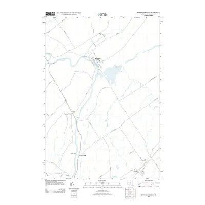
2013 Map of Rensselaer Falls
USGS Topo · Published 2013About this map
The Oswegatchie River defines the western corridor of this Saint Lawrence County landscape, winding past the village of Rensselaer Falls and the riverside settlement at Coopers Falls. This survey illustrates a network of rural roads and historical burial sites that serve as vital markers for local genealogists, including Walruth Cem, Kendrew Cem, and Saint Henrys Cem near De Kalb Junction. The drainage patterns of Gulf Cr and Cook Cr converge toward Lower Lake, highlighting the water-rich geography of the North Country.
Find a feature on this map
59 named features on this map. Tap any name to fly to it.
Don’t see what you’re looking for? This feature index may not catch every label — zoom into the map to look around manually.
Map Details
Editions of this 2013 Rensselaer Falls Map
This is the sole edition of this map. No revisions or reprints were ever made.
Other maps of this area

1904 · Ogdensburg
USGS Topo · 1:62,500

1905 · Ogdensburg
USGS Topo · 1:62,500

1910 · Canton
USGS Topo · 1:62,500

1911 · Canton
USGS Topo · 1:62,500

1915 · Gouverneur
USGS Topo · 1:62,500

1915 · Russell
USGS Topo · 1:62,500

1918 · Russell
USGS Topo · 1:62,500

1937 · Gouverneur
USGS Topo · 1:62,500

1943 · Ogdensburg East
USGS Topo · 1:31,680

1943 · Rensselaer Falls
USGS Topo · 1:31,680