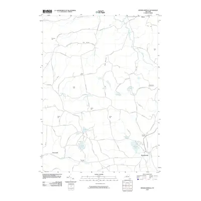
2010 Map of Rensselaerville
USGS Topo · Published 2010About this map
Rensselaerville anchors the southeast corner of this landscape, where Tenmile Creek flows past the dramatic Rensselaerville Falls. The terrain is defined by a series of named ridges and hollows, including West Mountain and the deep cleft of The Gulf. Settlement patterns follow the winding valley roads, connecting small clusters at Hawversville, Zucks Corners, and Shoefelt Corners.
Find a feature on this map
81 named features on this map. Tap any name to fly to it.
Don’t see what you’re looking for? This feature index may not catch every label — zoom into the map to look around manually.
Map Details
Editions of this 2010 Rensselaerville Map
This is the sole edition of this map. No revisions or reprints were ever made.
Other maps of this area

1893 · Durham
USGS Topo · 1:62,500

1894 · Durham
USGS Topo · 1:62,500

1898 · Schoharie
USGS Topo · 1:62,500

1900 · Schoharie
USGS Topo · 1:62,500

1900 · Schoharie
USGS Topo · 1:31,680

1900 · Berne
USGS Topo · 1:62,500

1901 · Gilboa
USGS Topo · 1:62,500

1903 · Gilboa
USGS Topo · 1:62,500

1903 · Berne
USGS Topo · 1:62,500
1943 · Westerlo
USGS Topo · 1:24,000