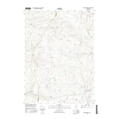
2016 Map of Rensselaerville
USGS Topo · Published 2016About this map
Rensselaerville anchors the southeast corner of this landscape where the Helderberg Plateau meets the Catskill foothills along the border of Schoharie and Albany Counties. This modern topographic study reveals a terrain of high ridges and hollows, including Cannady Hill and W Mtn, that direct the flow of waters like Little Schoharie Cr and Switz Kill. The settlement pattern follows these natural contours, with roads like Bradt Hollow Rd and Cheese Hill Rd connecting small clusters of homes and family farms in areas such as Brat Hollow and Hawversville.
Find a feature on this map
93 named features on this map. Tap any name to fly to it.
Don’t see what you’re looking for? This feature index may not catch every label — zoom into the map to look around manually.
Map Details
Editions of this 2016 Rensselaerville Map
This is the sole edition of this map. No revisions or reprints were ever made.
Other maps of this area

1893 · Durham
USGS Topo · 1:62,500

1894 · Durham
USGS Topo · 1:62,500

1898 · Schoharie
USGS Topo · 1:62,500

1900 · Schoharie
USGS Topo · 1:62,500

1900 · Schoharie
USGS Topo · 1:31,680

1900 · Berne
USGS Topo · 1:62,500

1901 · Gilboa
USGS Topo · 1:62,500

1903 · Gilboa
USGS Topo · 1:62,500

1903 · Berne
USGS Topo · 1:62,500
1943 · Westerlo
USGS Topo · 1:24,000