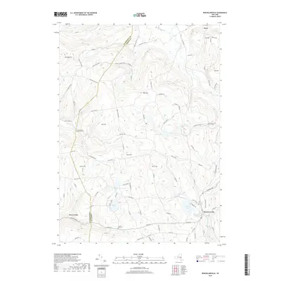
2019 Map of Rensselaerville
USGS Topo · Published 2019About this map
Rensselaerville sits at the base of a high-elevation landscape where the Schoharie Co Albany Co line divides the hills. The terrain is defined by a series of prominent peaks and deep hollows, including Cook Hill, North Hill, and the steep Brat Hollow. Water is central to the area's layout, with Myosotis Lake and Crystal Lake serving as focal points for local geography, while the Switz Kill and Fox Cr drain the uplands. This 2019 survey documents a rural infrastructure where historic routes like the Delaware Tpke and Hauverville Rd connect small settlements. For those tracing local heritage, the map identifies several significant resting places, including the Huntersland Christian Cem, the Gifford Hollow Burial Ground, and the Crystal Lake Cem, all preserved within this high-country setting.
Find a feature on this map
63 named features on this map. Tap any name to fly to it.
Don’t see what you’re looking for? This feature index may not catch every label — zoom into the map to look around manually.
Map Details
Editions of this 2019 Rensselaerville Map
This is the sole edition of this map. No revisions or reprints were ever made.
Other maps of this area

1893 · Durham
USGS Topo · 1:62,500

1894 · Durham
USGS Topo · 1:62,500

1898 · Schoharie
USGS Topo · 1:62,500

1900 · Schoharie
USGS Topo · 1:62,500

1900 · Schoharie
USGS Topo · 1:31,680

1900 · Berne
USGS Topo · 1:62,500

1901 · Gilboa
USGS Topo · 1:62,500

1903 · Gilboa
USGS Topo · 1:62,500

1903 · Berne
USGS Topo · 1:62,500
1943 · Westerlo
USGS Topo · 1:24,000