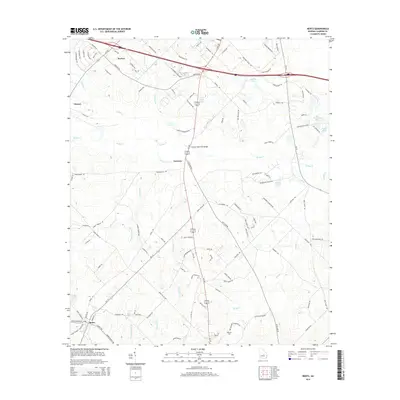
2014 Map of Rentz
USGS Topo · Published 2014About this map
Rentz and the surrounding Laurens County landscape are defined by a network of agricultural roads and winding tributaries of the Oconee River basin. The town of Rentz anchors the southwestern portion of the sheet, while smaller rural nodes like Harlow and Garretta sit along the primary north-south corridor of Us-319. The terrain is characterized by a high density of named water features, including Turkey Creek, Mosquito Creek, and Bluewater Creek, which carve through the land alongside numerous local impoundments such as Hardin Lake and Lamar Smith Lake. Genealogists and local historians can locate the Pearson Cemetery in the southern reaches and identify family-named landmarks like the Claxton Memorial Bridge. This 2014 survey illustrates the modern persistence of traditional rural Georgia settlement patterns, where family landholdings and small communities remain tied to the region's creek systems.
Find a feature on this map
111 named features on this map. Tap any name to fly to it.
Don’t see what you’re looking for? This feature index may not catch every label — zoom into the map to look around manually.
Map Details
Editions of this 2014 Rentz Map
This is the sole edition of this map. No revisions or reprints were ever made.
Other maps of this area

1957 · Macon
USGS Topo · 1:250,000

1958 · Macon
USGS Topo · 1:250,000

1964 · Macon
USGS Topo · 1:250,000

1973 · Cadwell
USGS Topo · 1:24,000

1974 · Lowery
USGS Topo · 1:24,000

1974 · Five Points
USGS Topo · 1:24,000

1974 · Rentz
USGS Topo · 1:24,000

1974 · Dudley
USGS Topo · 1:24,000

1974 · East Dublin
USGS Topo · 1:24,000
1974 · Dexter
USGS Topo · 1:24,000