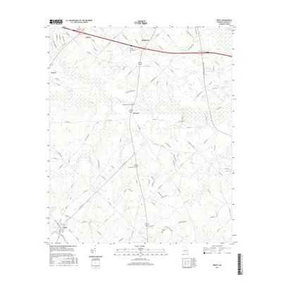
2017 Map of Rentz
USGS Topo · Published 2017About this map
Rentz anchors the southern portion of this landscape, where a grid of local streets like Simpson Ave and Railroad St intersects the regional highway system. The terrain is defined by a dense network of slow-moving waterways, including Turkey Creek, Bluewater Creek, and Mosquito Creek, which drain toward the Oconee River at the far northeastern corner. These wetlands create a distinctive pattern of drainage and land use, separating small named settlements such as Garretta, Harlow, and Vincent.
Find a feature on this map
115 named features on this map. Tap any name to fly to it.
Don’t see what you’re looking for? This feature index may not catch every label — zoom into the map to look around manually.
Map Details
Editions of this 2017 Rentz Map
This is the sole edition of this map. No revisions or reprints were ever made.
Other maps of this area

1957 · Macon
USGS Topo · 1:250,000

1958 · Macon
USGS Topo · 1:250,000

1964 · Macon
USGS Topo · 1:250,000

1973 · Cadwell
USGS Topo · 1:24,000

1974 · Lowery
USGS Topo · 1:24,000

1974 · Five Points
USGS Topo · 1:24,000

1974 · Rentz
USGS Topo · 1:24,000

1974 · Dudley
USGS Topo · 1:24,000

1974 · East Dublin
USGS Topo · 1:24,000
1974 · Dexter
USGS Topo · 1:24,000