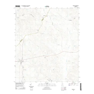
2014 Map of Repton
USGS Topo · Published 2014About this map
Burnt Corn Cr and Brushy Cr wind through the borderlands of Monroe and Conecuh counties, shaping a landscape defined by small rural settlements and a dense network of country roads. The town of Repton serves as a local hub, where Railroad St and Front St highlight a classic timber-and-transit layout typical of south Alabama's interior. Genealogy researchers will find significant value in the numerous family and community burial grounds documented here, such as Limestone Faulk Cem and Beulah Cem near Drewry. To the east, the map traces the winding paths of CR-20 toward Nichburg and CR-11 as it passes Bermuda, illustrating the enduring nature of these historical travel corridors across the coastal plain's undulating terrain.
Find a feature on this map
44 named features on this map. Tap any name to fly to it.
Don’t see what you’re looking for? This feature index may not catch every label — zoom into the map to look around manually.
Map Details
Editions of this 2014 Repton Map
This is the sole edition of this map. No revisions or reprints were ever made.
Other maps of this area

1953 · Andalusia
USGS Topo · 1:250,000

1957 · Andalusia
USGS Topo · 1:250,000

1971 · Range
USGS Topo · 1:24,000

1971 · Castleberry
USGS Topo · 1:24,000

1971 · Belleville
USGS Topo · 1:24,000

1971 · China
USGS Topo · 1:24,000

1971 · Burnt Corn
USGS Topo · 1:24,000

1971 · Repton
USGS Topo · 1:24,000

1972 · Monroeville
USGS Topo · 1:24,000

1972 · Frisco City SE
USGS Topo · 1:24,000