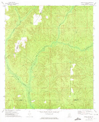
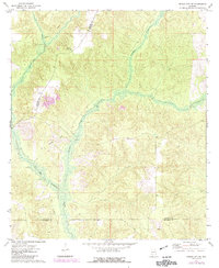
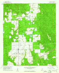
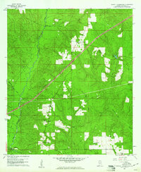
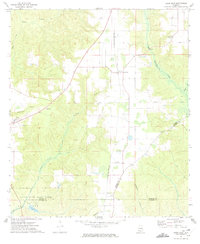
1972 Map of Frisco City SE
USGS Topo · Published 1974About this map
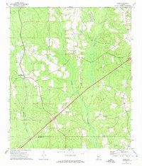
Big Escambia Creek winds through the southern Alabama timberlands in this early 1970s survey, marking a landscape defined by its hydrology and history of transport. The terrain is characterized by the convergence of several county boundaries, where Monroe, Conecuh, and Escambia counties meet amidst a network of drainage basins. Human activity is centered on small settlements such as Range and Dean, which are connected by a landscape showing clear signs of earlier industrial infrastructure. The presence of an Old Railroad Grade cutting across the topography highlights the area's legacy of rail-based commerce. On higher ground, the Wild Fork Lookout Tower stands as a significant landmark, providing a necessary vantage point over the dense woodland that dominates this part of Conecuh County.
Find a feature on this map
7 named features on this map. Tap any name to fly to it.
Don’t see what you’re looking for? This feature index may not catch every label — zoom into the map to look around manually.
Map Details
Editions of this 1972 Frisco City SE Map
2 editions found
Other maps of this area

1953 · Andalusia
USGS Topo · 1:250,000

1957 · Andalusia
USGS Topo · 1:250,000
1960 · Huxford
USGS Topo · 1:24,000
1960 · Barnett Crossroads
USGS Topo · 1:24,000
1960 · Wallace
USGS Topo · 1:24,000
1971 · Range
USGS Topo · 1:24,000
1971 · Repton
USGS Topo · 1:24,000
1972 · Frisco City
USGS Topo · 1:24,000
1972 · Uriah East
USGS Topo · 1:24,000
1972 · Excel
USGS Topo · 1:24,000