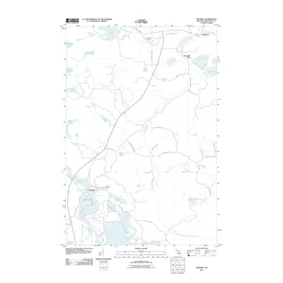
2011 Map of Republic
USGS Topo · Published 2011About this map
Republic sits as a primary settlement in this Marquette County landscape, defined by its relationship to the sprawling Michigamme Basin and the winding Michigamme River. The map illustrates a region where water and mining heritage intersect, featuring the prominent Humboldt Mine to the north near the community of Humboldt. This 2011 survey documents the complex hydrological network of the area, including The Basin, Black River, and numerous smaller bodies of water like Lake Lory and Milwaukee Lake. Genealogists and local historians will find the exact locations of the Republic Cemetery and Humboldt Cemetery useful for land-use and family research. The settlement of Republic is further detailed with the presence of the Republic Post Office, while the surrounding terrain is crisscrossed by an extensive network of county roads like County Hwy 496 and County Hwy LLK, reflecting the modern rural infrastructure of Michigan's Upper Peninsula.
Find a feature on this map
59 named features on this map. Tap any name to fly to it.
Don’t see what you’re looking for? This feature index may not catch every label — zoom into the map to look around manually.
Map Details
Editions of this 2011 Republic Map
This is the sole edition of this map. No revisions or reprints were ever made.
Other maps of this area

1899 · Witbeck
USGS Topo · 1:62,500

1955 · Champion
USGS Topo · 1:24,000

1955 · Witch Lake
USGS Topo · 1:24,000

1955 · Diorite
USGS Topo · 1:24,000

1955 · Witch Lake NE
USGS Topo · 1:24,000

1955 · Greenwood
USGS Topo · 1:24,000

1955 · Republic
USGS Topo · 1:62,500

1955 · Republic
USGS Topo · 1:24,000

1955 · Witch Lake
USGS Topo · 1:62,500

1955 · Republic SW
USGS Topo · 1:24,000