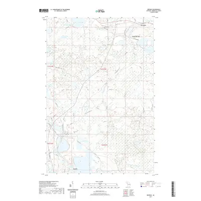
2019 Map of Republic
USGS Topo · Published 2019About this map
The Michigamme River and the settlement of Republic anchor the southern reaches of this landscape, where the waterway expands into White Horse Bay. The area's industrial legacy is central to the terrain, most notably at the Humboldt Mine near the northern settlement of Humboldt. This mining heritage is literally traced by the Iron Ore Heritage Trail, which winds through the central portion of the quadrangle, following the historical paths of resource extraction. The map reveals a dense network of water bodies and wetlands, from Peterson Lake in the south to Fish Lake in the north. Local history is anchored at the Republic Cem and Humboldt Cem, while the complex drainage of the W Br Middle Br Escanaba River and the Black River indicates a landscape shaped by both glacial history and the needs of the regional iron industry.
Find a feature on this map
72 named features on this map. Tap any name to fly to it.
Don’t see what you’re looking for? This feature index may not catch every label — zoom into the map to look around manually.
Map Details
Editions of this 2019 Republic Map
This is the sole edition of this map. No revisions or reprints were ever made.
Other maps of this area

1899 · Witbeck
USGS Topo · 1:62,500

1955 · Champion
USGS Topo · 1:24,000

1955 · Witch Lake
USGS Topo · 1:24,000

1955 · Diorite
USGS Topo · 1:24,000

1955 · Witch Lake NE
USGS Topo · 1:24,000

1955 · Greenwood
USGS Topo · 1:24,000

1955 · Republic
USGS Topo · 1:62,500

1955 · Republic
USGS Topo · 1:24,000

1955 · Witch Lake
USGS Topo · 1:62,500

1955 · Republic SW
USGS Topo · 1:24,000