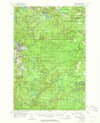
1955 Map of Republic
USGS Topo · Published 1964About this map
Iron mining operations dominate the landscape of the Humboldt and Republic townships in the mid-1950s. The map illustrates a region transitioning from active industrial extraction to recreational and forestry use, evidenced by the large Republic Mine and Humboldt Mine sites situated alongside the Ely State Forest. In the northern section, the Duluth South Shore and Atlantic railroad services the settlements of Clarksburg and Snowville, while a Drive-in Theater near the highway reflects mid-century social life. To the west, the complex waters of The Basin and Michigamme Basin flank the town of Republic, where the neighborhood of Park Hill sits near the river banks. This survey also records the location of the Black River Sch (Abandoned), offering a specific point of interest for those tracing the history of rural education in Marquette County.
Find a feature on this map
106 named features on this map. Tap any name to fly to it.
Don’t see what you’re looking for? This feature index may not catch every label — zoom into the map to look around manually.
Map Details
Editions of this 1955 Republic Map
3 editions found

Other maps of this area

1899 · Sagola
USGS Topo · 1:62,500

1899 · Witbeck
USGS Topo · 1:62,500

1952 · Ishpeming
USGS Topo · 1:62,500

1952 · Ishpeming
USGS Topo · 1:24,000

1954 · Negaunee SW
USGS Topo · 1:24,000

1954 · Negaunee
USGS Topo · 1:62,500

1955 · Champion
USGS Topo · 1:24,000

1955 · Witch Lake
USGS Topo · 1:24,000

1955 · Ralph NW
USGS Topo · 1:24,000

1955 · Ralph NE
USGS Topo · 1:24,000