
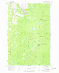
1955 Map of Republic SW
USGS Topo · Published 1957About this map
The Michigamme River meanders southward through the heart of this mid-1950s landscape, defining the transition between the townships of Republic and Humboldt. This section of the Michigamme State Forest is characterized by an intricate network of glacial lakes and wetlands. The drainage pattern is particularly complex, with Greek Gambles Creek and Caps Creek feeding into the main river channel, while isolated water bodies like Big Lick Lake and Loon Lake dot the central plains.
Find a feature on this map
33 named features on this map. Tap any name to fly to it.
Don’t see what you’re looking for? This feature index may not catch every label — zoom into the map to look around manually.
Map Details
Editions of this 1955 Republic SW Map
2 editions found
Other maps of this area

1899 · Sagola
USGS Topo · 1:62,500

1899 · Witbeck
USGS Topo · 1:62,500

1955 · Witch Lake
USGS Topo · 1:24,000

1955 · Ralph NW
USGS Topo · 1:24,000

1955 · Ralph NE
USGS Topo · 1:24,000

1955 · Witch Lake NE
USGS Topo · 1:24,000

1955 · Greenwood
USGS Topo · 1:24,000

1955 · Republic
USGS Topo · 1:62,500

1955 · Republic
USGS Topo · 1:24,000

1955 · Witch Lake
USGS Topo · 1:62,500