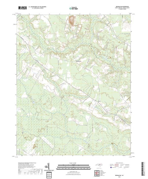
2022 Map of Republican
USGS Topo · Published 2022About this map
Roquist Pocosin dominates the southern landscape of this Bertie County study, illustrating the dense, boggy wetlands that have long shaped the region's geography and development. The settlement of Republican sits at a junction of rural routes, including Republican RD and Mt Olive RD, serving as a central point for the surrounding agricultural tracts. To the southeast, the small community of Drew is situated near the headwaters of Chiska Cr, while the winding Cashie River and its associated Connarity Swamp define the northern hydrology. The abundance of named roads such as Parkers School Rd and Spruill Farm RD points to a landscape historically organized around family-owned farms and local schools, providing a detailed look at contemporary land division and access within this traditional coastal plain environment.
Find a feature on this map
29 named features on this map. Tap any name to fly to it.
Don’t see what you’re looking for? This feature index may not catch every label — zoom into the map to look around manually.
Map Details
Editions of this 2022 Republican Map
This is the sole edition of this map. No revisions or reprints were ever made.
Other maps of this area

1901 · Williamston
USGS Topo · 1:62,500

1902 · Williamston
USGS Topo · 1:62,500

1943 · Plymouth
USGS Topo · 1:125,000

1953 · Norfolk
USGS Topo · 1:250,000

1953 · Rocky Mount
USGS Topo · 1:250,000

1954 · Rocky Mount
USGS Topo · 1:250,000

1972 · Republican
USGS Topo · 1:24,000

1972 · Woodville
USGS Topo · 1:24,000

1972 · Aulander
USGS Topo · 1:24,000

1973 · Kelford
USGS Topo · 1:24,000