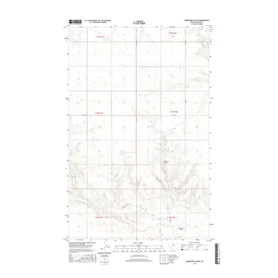
2017 Map of Reservoir Coulee
USGS Topo · Published 2017About this map
Reser Cr winds through this section of Blaine County, defining a landscape shaped by intermittent watercourses and technical township boundaries. The northern reaches of the quadrangle are marked by the intersection of Lonesome Rd and Reser Rd, providing access to the expansive range land. The drainage patterns of the northern Great Plains are clearly visible here, particularly where the namesake Reservoir Coulee and the distinct Redrock Coulee carve into the terrain.
Find a feature on this map
14 named features on this map. Tap any name to fly to it.
Don’t see what you’re looking for? This feature index may not catch every label — zoom into the map to look around manually.
Map Details
Editions of this 2017 Reservoir Coulee Map
This is the sole edition of this map. No revisions or reprints were ever made.
Other maps of this area

1904 · Yantic
USGS Topo · 1:62,500

1904 · Havre
USGS Topo · 1:62,500

1912 · Zurich
USGS Topo · 1:125,000

1912 · Thibedeau Lake
USGS Topo · 1:125,000

1953 · Havre
USGS Topo · 1:250,000

1957 · Havre
USGS Topo · 1:250,000

1958 · Havre
USGS Topo · 1:250,000

1964 · Telescope Coulee
USGS Topo · 1:24,000

1964 · Havre SE
USGS Topo · 1:24,000
1964 · Lohman SE
USGS Topo · 1:24,000