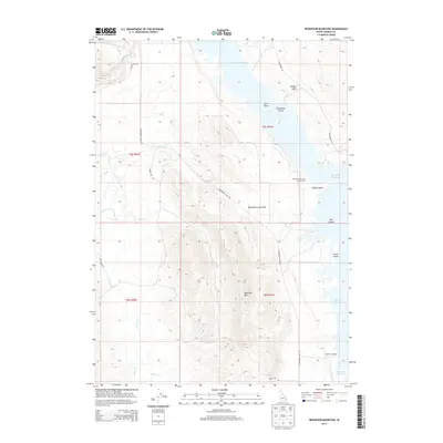
2013 Map of Reservoir Mountain
USGS Topo · Published 2013About this map
Blackfoot Reservoir dominates the eastern landscape of this Idaho quadrangle, where the water's reach creates a complex shoreline of points and islands. The terrain transitions from the aquatic expanse of the reservoir to the volcanic geology of the Blackfoot Lava Field in the central portion of the map. High ground is marked by features like Reservoir Mtn and Badger Knoll, while a series of seasonal and permanent watercourses including Corral Cr, Chicken Cr, and Bear Cr drain the surrounding slopes. The presence of Hopkins Landing suggests a point of lakeside activity, while the Northside Narrows Access Area provides a gateway to the reservoir’s northern reaches. This 2013 survey illustrates the intersection of water management and natural geologic formations in Caribou County, showing how roads like Government Dam Rd and Skinny Dip Rd navigate the varied topography.
Find a feature on this map
26 named features on this map. Tap any name to fly to it.
Don’t see what you’re looking for? This feature index may not catch every label — zoom into the map to look around manually.
Map Details
Editions of this 2013 Reservoir Mountain Map
This is the sole edition of this map. No revisions or reprints were ever made.
Other maps of this area

1914 · Henry
USGS Topo · 1:48,000

1916 · Henry
USGS Topo · 1:62,500

1917 · Portneuf
USGS Topo · 1:62,500

1917 · Cranes Flat
USGS Topo · 1:62,500

1918 · Paradise Valley
USGS Topo · 1:62,500

1955 · Driggs
USGS Topo · 1:250,000

1955 · Preston
USGS Topo · 1:250,000

1958 · Driggs
USGS Topo · 1:250,000

1958 · Preston
USGS Topo · 1:250,000

1962 · Driggs
USGS Topo · 1:250,000