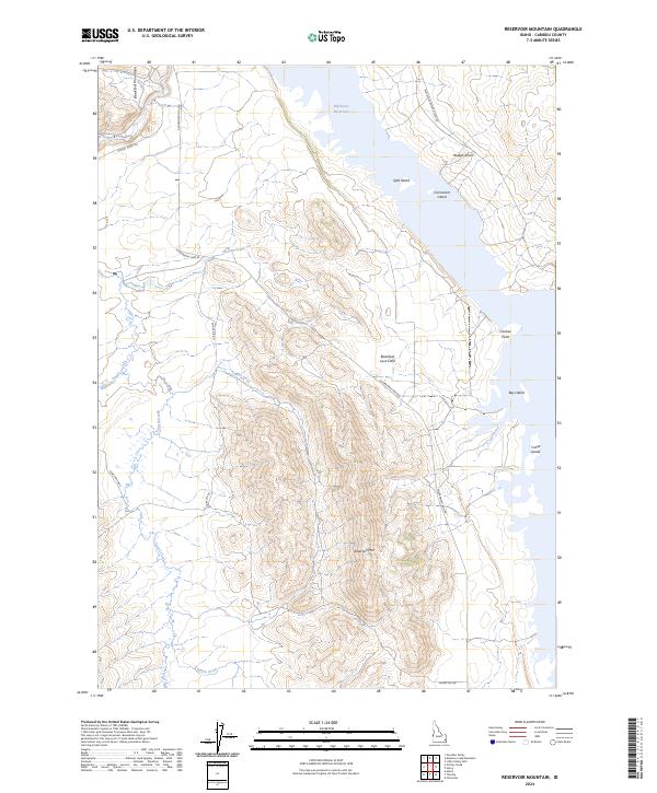
2024 Map of Reservoir Mountain
USGS Topo · Published 2024About this map
Blackfoot Reservoir dominates this high-altitude landscape in Caribou County, where the sprawling water body is punctuated by several prominent landforms including Split Island, Cormorant Island, and Bay Island. The terrain is characterized by the volcanic history of the region, specifically the Blackfoot Lava Field which sits adjacent to the reservoir's western reaches. Rising above the water and lava flows is Reservoir Mtn, a significant topographic feature that overlooks the complex network of mountain drainages like Bear Creek and Chicken Creek. A modest network of backcountry access routes, such as Government Dam Rd and the aptly named Skinny Dip Rd, provides the primary means of navigating this remote portion of the Blackfoot Mountains. These roads trace the rugged contours and connect the shoreline features like Chicken Point to the surrounding peaks.
Find a feature on this map
24 named features on this map. Tap any name to fly to it.
Don’t see what you’re looking for? This feature index may not catch every label — zoom into the map to look around manually.
Map Details
Editions of this 2024 Reservoir Mountain Map
This is the sole edition of this map. No revisions or reprints were ever made.
Other maps of this area

1914 · Henry
USGS Topo · 1:48,000

1916 · Henry
USGS Topo · 1:62,500

1917 · Portneuf
USGS Topo · 1:62,500

1917 · Cranes Flat
USGS Topo · 1:62,500

1918 · Paradise Valley
USGS Topo · 1:62,500

1955 · Driggs
USGS Topo · 1:250,000

1955 · Preston
USGS Topo · 1:250,000

1958 · Driggs
USGS Topo · 1:250,000

1958 · Preston
USGS Topo · 1:250,000

1962 · Driggs
USGS Topo · 1:250,000