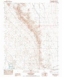
1983 Map of Resting Spring
USGS Topo · Published 1984About this map
The Resting Spring Range dominates this portion of the Mojave Desert in eastern Inyo County, providing a stark topographical barrier between the Chicago Valley and the western flats. Water remains the defining resource of this arid landscape, evidenced by the clustered developments at Tecopa Hot Springs and the reliable flow of the Amargosa River as it passes the Trailer Park. Historical transit is marked by the Old Spanish Trail, which cuts across the southern portion of the quadrangle, tracing a path used by travelers long before modern surveying. The map captures the remote nature of the region, where isolated water sources like Chappo Spring and Resting Spring served as vital landmarks for those traversing the valley floor or the steep slopes of the nearby mountains.
Find a feature on this map
11 named features on this map. Tap any name to fly to it.
Don’t see what you’re looking for? This feature index may not catch every label — zoom into the map to look around manually.
Map Details
Editions of this 1983 Resting Spring Map
2 editions found
Other maps of this area

1908 · Furnace Creek
USGS Topo · 1:250,000

1910 · Furnace Creek
USGS Topo · 1:250,000

1933 · Avawatz Mountains
USGS Topo · 1:250,000

1940 · Eagle Tank
USGS Topo · 1:62,500

1947 · Trona
USGS Topo · 1:250,000

1948 · Trona
USGS Topo · 1:250,000

1948 · Death Valley
USGS Topo · 1:250,000

1950 · Tecopa
USGS Topo · 1:62,500

1951 · Tecopa
USGS Topo · 1:62,500

1951 · Eagle Mtn
USGS Topo · 1:62,500