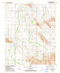
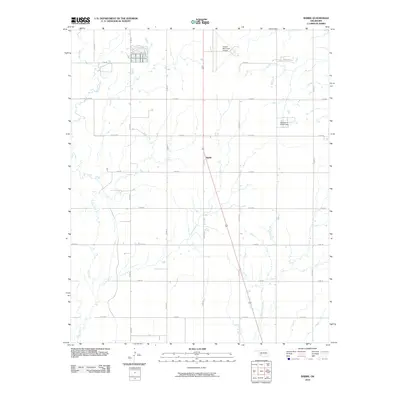
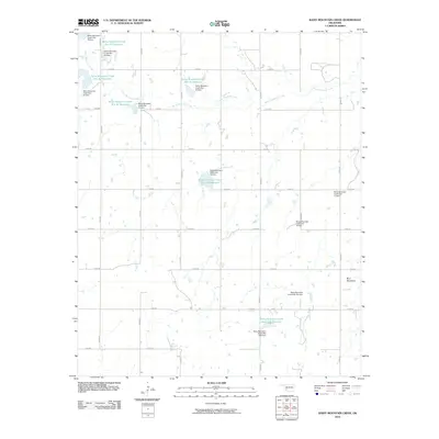
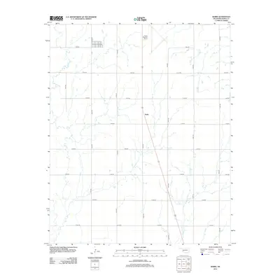
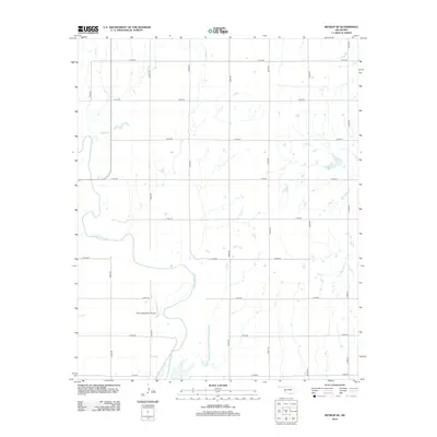
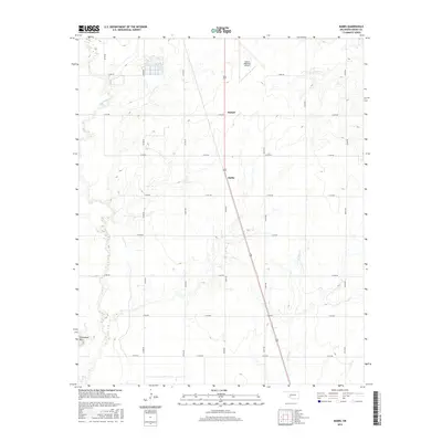
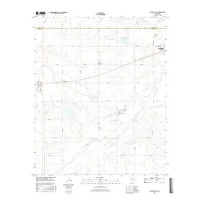
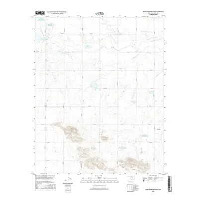
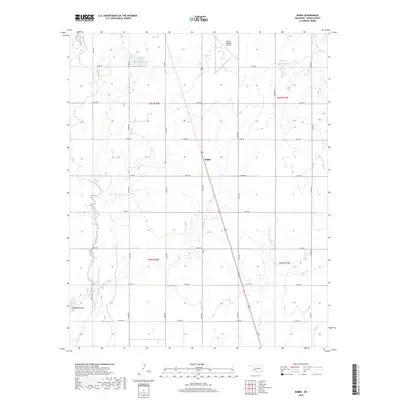
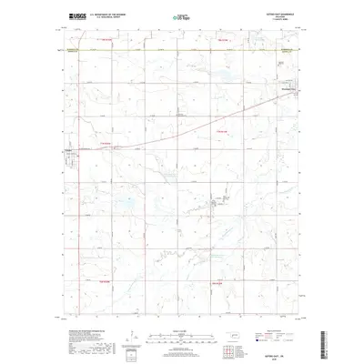
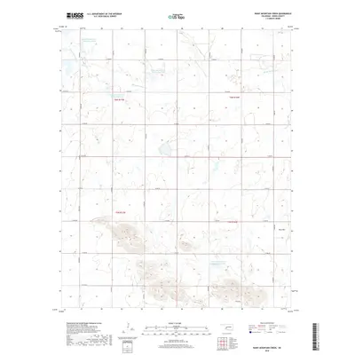
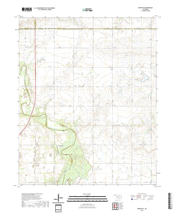
1989 Map of Retrop SE
USGS Topo · Published 1989About this map
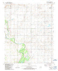
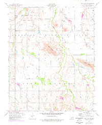
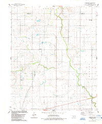
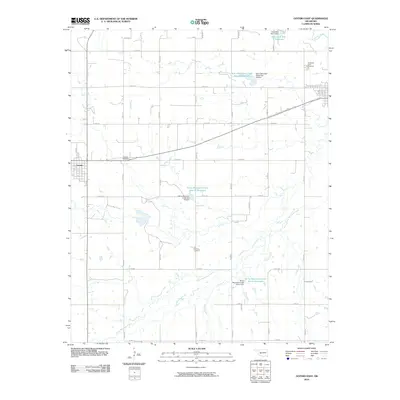
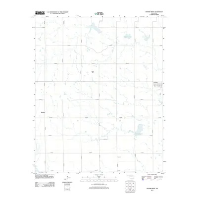
The North Fork Red River carves a significant path through this southwestern Oklahoma landscape, marking the natural boundary between Kiowa and Greer counties. By the late 1980s, this area reflects a landscape dedicated to both conservation and resource extraction. The southern portion of the map is dominated by the Altus-Lugert State Wildlife Management Area, where the river feeds into the northern reaches of Lake Altus. This riparian corridor contrasts with the surrounding uplands, which are characterized by the township and range grid common to the Great Plains. Industrial activity is evident through numerous extraction points, including a prominent Oil Well and several other labeled Well sites, while a lone Radio Tower stands on the higher ground of the northeast, serving as a modern navigational landmark amidst the rural terrain.
Find a feature on this map
12 named features on this map. Tap any name to fly to it.
Don’t see what you’re looking for? This feature index may not catch every label — zoom into the map to look around manually.
Map Details
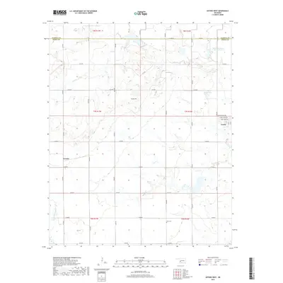
Editions of this 1989 Retrop SE Map
This is the sole edition of this map. No revisions or reprints were ever made.
Historical Maps of Beckham County Through Time
76 maps found
1956 Bally Mountain
Kiowa County, OK
1956 Glen Mountains
Kiowa County, OK
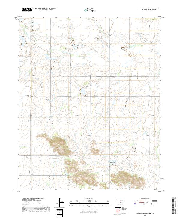
1956 Rainy Mountain Creek
Kiowa County, OK
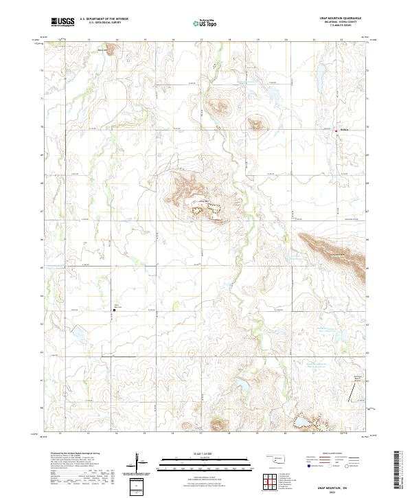
1956 Unap Mountain
Kiowa County, OK
1963 Babbs
Kiowa County, OK
1964 Long Mountain
Kiowa County, OK
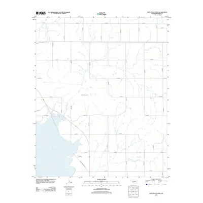
1971 Lake Altus
Kiowa County, OK
1984 Cambridge
Kiowa County, OK
1984 Gotebo East
Kiowa County, OK
1984 Gotebo West
Kiowa County, OK
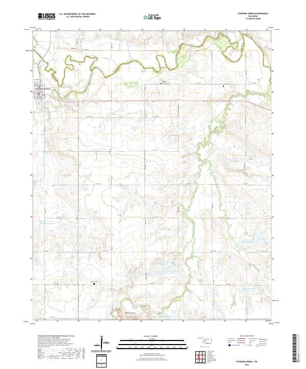
1984 Stinking Creek
Kiowa County, OK
1989 Retrop SE
Kiowa County, OK
1991 Bally Mountain
Kiowa County, OK
1991 Glen Mountains
Kiowa County, OK
1991 Rainy Mountain Creek
Kiowa County, OK
1991 Unap Mountain
Kiowa County, OK
2010 Babbs
Kiowa County, OK
2010 Bally Mountain
Kiowa County, OK
2010 Cambridge
Kiowa County, OK
2010 Glen Mountains
Kiowa County, OK
2010 Gotebo East
Kiowa County, OK
2010 Gotebo West
Kiowa County, OK
2010 Lake Altus
Kiowa County, OK
2010 Long Mountain
Kiowa County, OK
2010 Rainy Mountain Creek
Kiowa County, OK
2010 Retrop SE
Kiowa County, OK
2010 Stinking Creek
Kiowa County, OK
2010 Unap Mountain
Kiowa County, OK
2012 Babbs
Kiowa County, OK
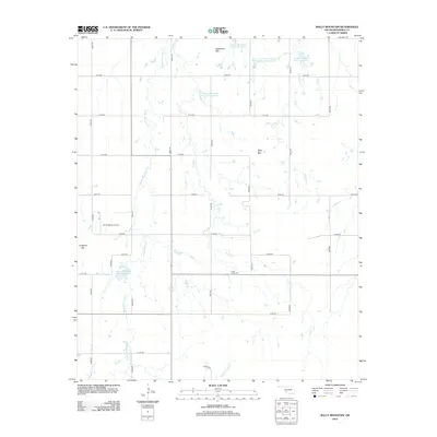
2012 Bally Mountain
Kiowa County, OK
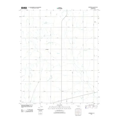
2012 Cambridge
Kiowa County, OK
2012 Glen Mountains
Kiowa County, OK
2012 Gotebo West
Kiowa County, OK
2012 Lake Altus
Kiowa County, OK
2012 Long Mountain
Kiowa County, OK
2012 Rainy Mountain Creek
Kiowa County, OK
2012 Retrop SE
Kiowa County, OK
2012 Stinking Creek
Kiowa County, OK
2012 Unap Mountain
Kiowa County, OK
2013 Gotebo East
Kiowa County, OK
2016 Babbs
Kiowa County, OK
2016 Bally Mountain
Kiowa County, OK
2016 Cambridge
Kiowa County, OK
2016 Glen Mountains
Kiowa County, OK
2016 Gotebo East
Kiowa County, OK
2016 Gotebo West
Kiowa County, OK
2016 Lake Altus
Kiowa County, OK
2016 Long Mountain
Kiowa County, OK
2016 Rainy Mountain Creek
Kiowa County, OK
2016 Retrop SE
Kiowa County, OK
2016 Stinking Creek
Kiowa County, OK
2016 Unap Mountain
Kiowa County, OK
2018 Babbs
Kiowa County, OK
2018 Bally Mountain
Kiowa County, OK
2018 Cambridge
Kiowa County, OK
2018 Glen Mountains
Kiowa County, OK
2018 Gotebo East
Kiowa County, OK
2018 Gotebo West
Kiowa County, OK
2018 Lake Altus
Kiowa County, OK
2018 Long Mountain
Kiowa County, OK
2018 Rainy Mountain Creek
Kiowa County, OK
2018 Retrop SE
Kiowa County, OK
2018 Stinking Creek
Kiowa County, OK
2018 Unap Mountain
Kiowa County, OK
2022 Babbs
Kiowa County, OK
2022 Bally Mountain
Kiowa County, OK
2022 Cambridge
Kiowa County, OK
2022 Glen Mountains
Kiowa County, OK
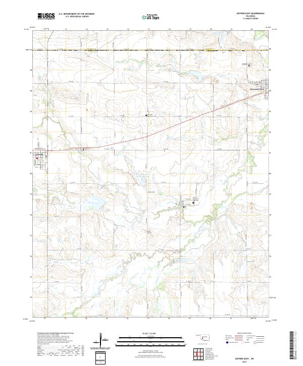
2022 Gotebo East
Kiowa County, OK
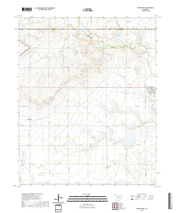
2022 Gotebo West
Kiowa County, OK
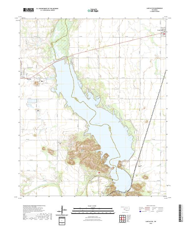
2022 Lake Altus
Kiowa County, OK
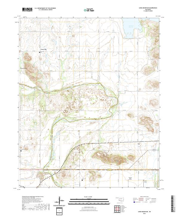
2022 Long Mountain
Kiowa County, OK
2022 Rainy Mountain Creek
Kiowa County, OK
2022 Retrop SE
Kiowa County, OK
2022 Stinking Creek
Kiowa County, OK
2022 Unap Mountain
Kiowa County, OK