
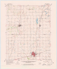
1961 Map of Hobart
USGS Topo · Published 1962About this map
The county seat of Hobart serves as a major transportation hub in the early 1960s, defined by a dense intersection of the Chicago Rock Island and Pacific and the St Louis San Francisco railroads. This infrastructure supported a diverse local economy visible in the Oil Field to the east and the agricultural centers of Sentinel and Rocky. The landscape is etched with local history, from the U S Military Reservation to numerous small-town landmarks like the Drive-in Theater and the Gravel Pit.
Find a feature on this map
43 named features on this map. Tap any name to fly to it.
Don’t see what you’re looking for? This feature index may not catch every label — zoom into the map to look around manually.
Map Details
Editions of this 1961 Hobart Map
2 editions found
Other maps of this area

1949 · Cooperton
USGS Topo · 1:62,500

1955 · Lawton
USGS Topo · 1:250,000

1955 · Clinton
USGS Topo · 1:250,000

1956 · Cordell
USGS Topo · 1:62,500

1956 · Rainy Mountain Creek
USGS Topo · 1:24,000

1956 · Cooperton
USGS Topo · 1:62,500

1957 · Clinton
USGS Topo · 1:250,000

1957 · Dill City
USGS Topo · 1:62,500

1961 · Gotebo
USGS Topo · 1:62,500

1961 · Retrop
USGS Topo · 1:62,500