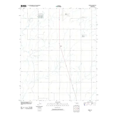
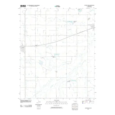
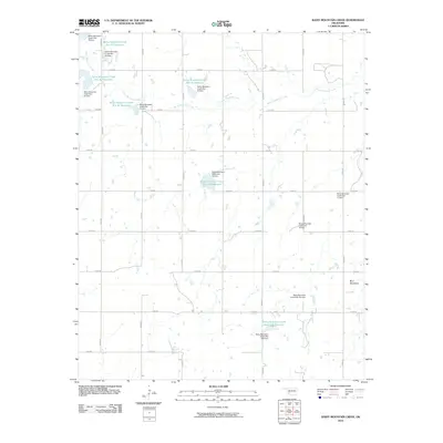
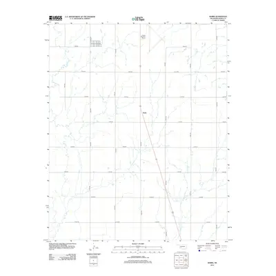
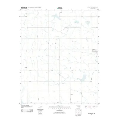
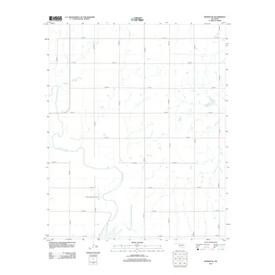
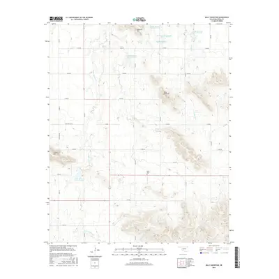
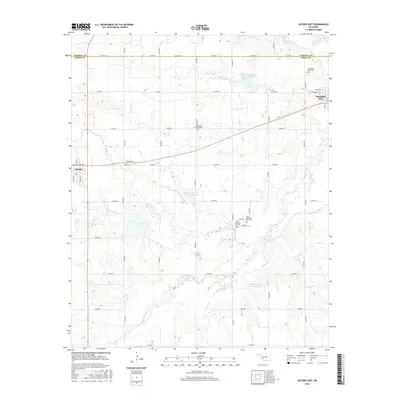
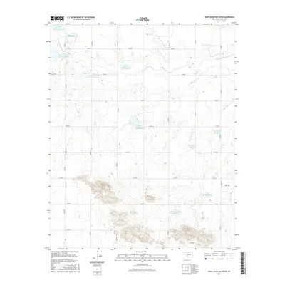
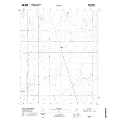
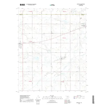
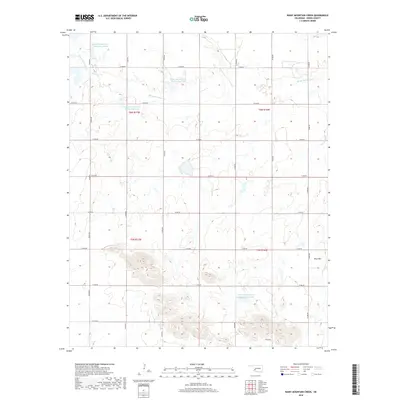
1956 Map of Rainy Mountain Creek
USGS Topo · Published 1959About this map
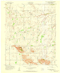
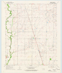
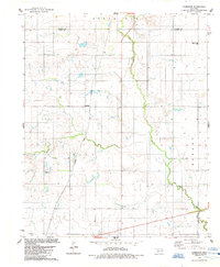
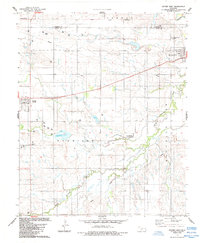
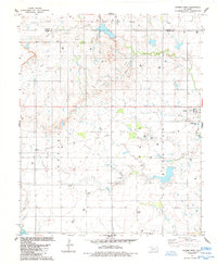
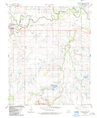
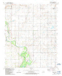
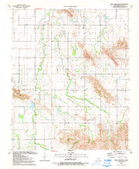
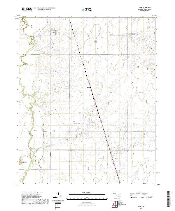
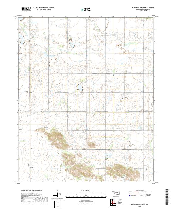
Rainy Mountain Creek winds through this Kiowa County landscape, where the transition from agricultural traditions to petroleum extraction is clearly visible. The area is anchored by the Rainy Mountain Church, a vital community landmark situated near the boundary of Hobart and Harrison. By the mid-1950s, the rural economy was defined by a mix of infrastructure, from the traditional Windmill providing water to the emerging energy sector evidenced by several Oil wells and an associated Slush tank. The presence of an extensive Pipeline underscores the industrial shifts occurring across these western Oklahoma plains. The map provides a precise look at the township and range divisions, showing how early 20th-century settlement patterns adapted to the local hydrology and the developing oil industry.
Find a feature on this map
11 named features on this map. Tap any name to fly to it.
Don’t see what you’re looking for? This feature index may not catch every label — zoom into the map to look around manually.
Map Details
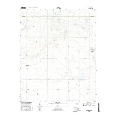
Editions of this 1956 Rainy Mountain Creek Map
This is the sole edition of this map. No revisions or reprints were ever made.
Historical Maps of Kiowa County Through Time
76 maps found
1956 Bally Mountain
Kiowa County, OK
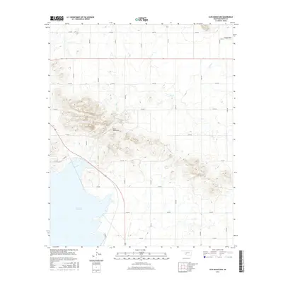
1956 Glen Mountains
Kiowa County, OK
1956 Rainy Mountain Creek
Kiowa County, OK
1956 Unap Mountain
Kiowa County, OK
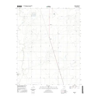
1963 Babbs
Kiowa County, OK
1964 Long Mountain
Kiowa County, OK
1971 Lake Altus
Kiowa County, OK
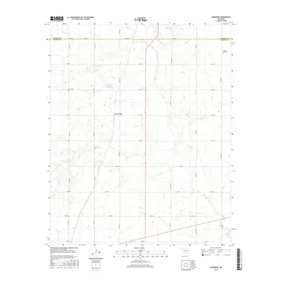
1984 Cambridge
Kiowa County, OK
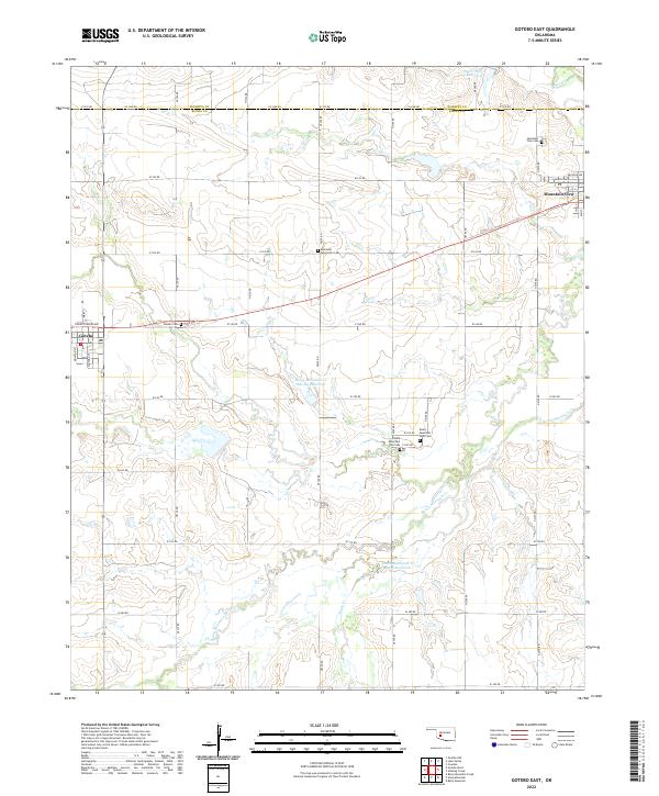
1984 Gotebo East
Kiowa County, OK
1984 Gotebo West
Kiowa County, OK
1984 Stinking Creek
Kiowa County, OK
1989 Retrop SE
Kiowa County, OK
1991 Bally Mountain
Kiowa County, OK
1991 Glen Mountains
Kiowa County, OK
1991 Rainy Mountain Creek
Kiowa County, OK
1991 Unap Mountain
Kiowa County, OK
2010 Babbs
Kiowa County, OK
2010 Bally Mountain
Kiowa County, OK
2010 Cambridge
Kiowa County, OK
2010 Glen Mountains
Kiowa County, OK
2010 Gotebo East
Kiowa County, OK
2010 Gotebo West
Kiowa County, OK
2010 Lake Altus
Kiowa County, OK
2010 Long Mountain
Kiowa County, OK
2010 Rainy Mountain Creek
Kiowa County, OK
2010 Retrop SE
Kiowa County, OK
2010 Stinking Creek
Kiowa County, OK
2010 Unap Mountain
Kiowa County, OK
2012 Babbs
Kiowa County, OK
2012 Bally Mountain
Kiowa County, OK
2012 Cambridge
Kiowa County, OK
2012 Glen Mountains
Kiowa County, OK
2012 Gotebo West
Kiowa County, OK
2012 Lake Altus
Kiowa County, OK
2012 Long Mountain
Kiowa County, OK
2012 Rainy Mountain Creek
Kiowa County, OK
2012 Retrop SE
Kiowa County, OK
2012 Stinking Creek
Kiowa County, OK
2012 Unap Mountain
Kiowa County, OK
2013 Gotebo East
Kiowa County, OK
2016 Babbs
Kiowa County, OK
2016 Bally Mountain
Kiowa County, OK
2016 Cambridge
Kiowa County, OK
2016 Glen Mountains
Kiowa County, OK
2016 Gotebo East
Kiowa County, OK
2016 Gotebo West
Kiowa County, OK
2016 Lake Altus
Kiowa County, OK
2016 Long Mountain
Kiowa County, OK
2016 Rainy Mountain Creek
Kiowa County, OK
2016 Retrop SE
Kiowa County, OK
2016 Stinking Creek
Kiowa County, OK
2016 Unap Mountain
Kiowa County, OK
2018 Babbs
Kiowa County, OK
2018 Bally Mountain
Kiowa County, OK
2018 Cambridge
Kiowa County, OK
2018 Glen Mountains
Kiowa County, OK
2018 Gotebo East
Kiowa County, OK
2018 Gotebo West
Kiowa County, OK
2018 Lake Altus
Kiowa County, OK
2018 Long Mountain
Kiowa County, OK
2018 Rainy Mountain Creek
Kiowa County, OK
2018 Retrop SE
Kiowa County, OK
2018 Stinking Creek
Kiowa County, OK
2018 Unap Mountain
Kiowa County, OK
2022 Babbs
Kiowa County, OK
2022 Bally Mountain
Kiowa County, OK
2022 Cambridge
Kiowa County, OK
2022 Glen Mountains
Kiowa County, OK
2022 Gotebo East
Kiowa County, OK
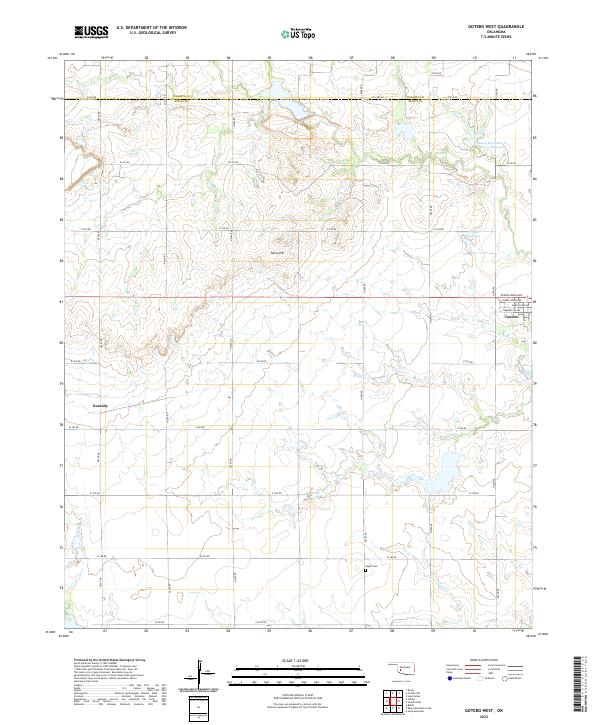
2022 Gotebo West
Kiowa County, OK
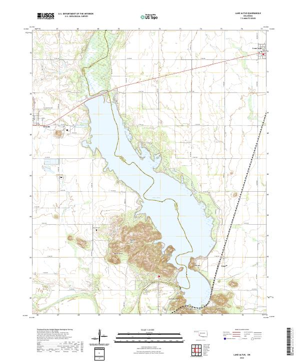
2022 Lake Altus
Kiowa County, OK
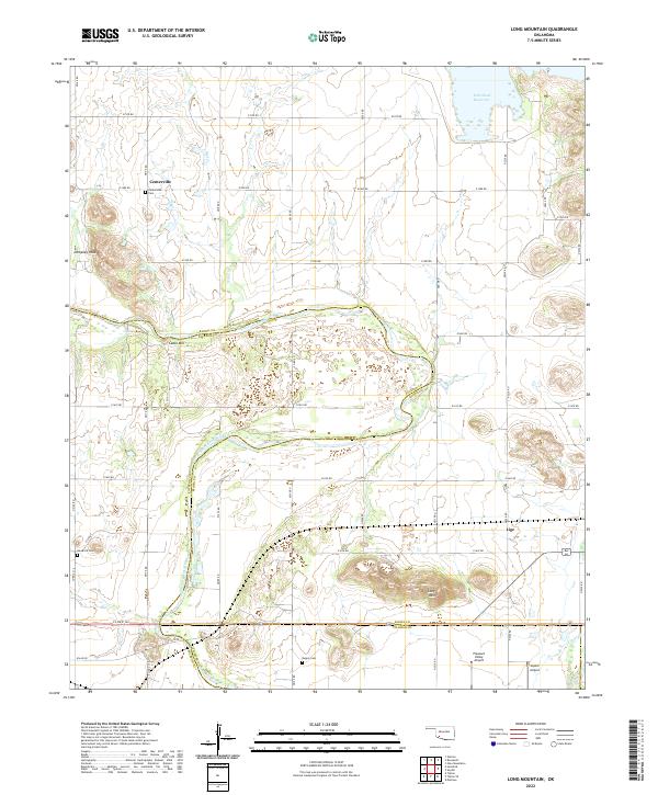
2022 Long Mountain
Kiowa County, OK
2022 Rainy Mountain Creek
Kiowa County, OK
2022 Retrop SE
Kiowa County, OK
2022 Stinking Creek
Kiowa County, OK
2022 Unap Mountain
Kiowa County, OK