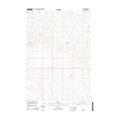
2015 Map of Reva
USGS Topo · Published 2015About this map
Reva serves as the central focal point for this section of Harding County, situated at the junction of several local routes. The landscape is defined by its drainages and vital water sources, such as McPherson Spring and Bar H Spring, which historically supported ranching operations in this semi-arid region. These springs feed into a network of intermittent streams including Fisher Cr, McPherson Cr, and Bar H Cr. The terrain is marked by distinctive features like Winter Draw and the more significant Gap Cr to the south. This survey illustrates the sparse, high-plains settlement pattern where roads like CR 735 and Highway 79 connect isolated homesteads and ranch lands across township boundaries like t19n r9e.
Find a feature on this map
17 named features on this map. Tap any name to fly to it.
Don’t see what you’re looking for? This feature index may not catch every label — zoom into the map to look around manually.
Map Details
Editions of this 2015 Reva Map
This is the sole edition of this map. No revisions or reprints were ever made.
Other maps of this area

1935 · Reva
USGS Topo · 1:125,000

1935 · Hoover
USGS Topo · 1:125,000

1954 · Lemmon
USGS Topo · 1:250,000

1957 · Lemmon
USGS Topo · 1:250,000

1968 · J B Hill
USGS Topo · 1:24,000

1968 · Reva
USGS Topo · 1:24,000

1968 · Flat Top Butte
USGS Topo · 1:24,000

1969 · Battleship Rock
USGS Topo · 1:24,000

1969 · Reva NW
USGS Topo · 1:24,000

1969 · Reva NE
USGS Topo · 1:24,000