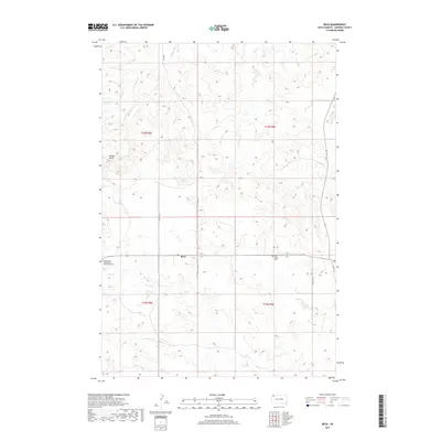
2017 Map of Reva
USGS Topo · Published 2017About this map
The small community of Reva sits at the intersection of local routes in this landscape of northwestern South Dakota. The area is defined by the drainages of Fisher Cr and Gap Cr, which wind through the township boundaries of t18n r9e and t19n r8e. This region preserves a significant moment in the Plains Wars at the Slim Buttes Battlefield Monument Cem, marking the 1876 engagement between the U.S. Army and the Lakota. Water sources like McPherson Spring and Bar H Spring are critical landmarks in this ranching country, where the topography transitions into features like Winter Draw. Modern connectivity is traced through named corridors such as Sabo Ridge Pl and Rocky Ridge Pl, which provide access to the remote sections of Harding County.
Find a feature on this map
19 named features on this map. Tap any name to fly to it.
Don’t see what you’re looking for? This feature index may not catch every label — zoom into the map to look around manually.
Map Details
Editions of this 2017 Reva Map
This is the sole edition of this map. No revisions or reprints were ever made.
Other maps of this area

1935 · Reva
USGS Topo · 1:125,000

1935 · Hoover
USGS Topo · 1:125,000

1954 · Lemmon
USGS Topo · 1:250,000

1957 · Lemmon
USGS Topo · 1:250,000

1968 · J B Hill
USGS Topo · 1:24,000

1968 · Reva
USGS Topo · 1:24,000

1968 · Flat Top Butte
USGS Topo · 1:24,000

1969 · Battleship Rock
USGS Topo · 1:24,000

1969 · Reva NW
USGS Topo · 1:24,000

1969 · Reva NE
USGS Topo · 1:24,000